
Port Moresby
At the northern end of Waigani Dr, by the University of Papua New Guinea, this is an island of calm. More than 2km of walkways thread under and through…
Getty Images/Robert Harding World Imagery
Squeezed between the dusty hills and the deep blue sea, gritty Port Moresby is not most travellers' idea of an enchanting capital. A spread-out collection of neighbourhoods – from modern office buildings in Town and Waigani and a glitzy marina full of yachts, to squatter shantytowns with no electricity or running water that cling to the hillsides and scruffy marketplaces where barefoot higglers from nearby villages sell their modest wares, the city illustrates the stark divide between PNG's haves and have-nots.
Port Moresby
At the northern end of Waigani Dr, by the University of Papua New Guinea, this is an island of calm. More than 2km of walkways thread under and through…

Port Moresby
This superb museum, beautifully remodelled for the country's 40th anniversary of independence, is the best introduction you can get to Papua New Guinea's…
Port Moresby
Right after the small store at Laloki River Gorge is the turn-off to Varirata National Park which, at 1000 hectares and over 800m high, is the highlight…
Port Moresby
The main Parliament Haus building is in the style of a Maprik- or Sepik-style haus tambaran, while the attached, circular cafeteria follows Highland…
Port Moresby
A turnoff near Fourteen Mile takes you to the large and carefully tended Bomana War Cemetery, where 4000 unknown PNG and Australian WWII soldiers are…
Port Moresby
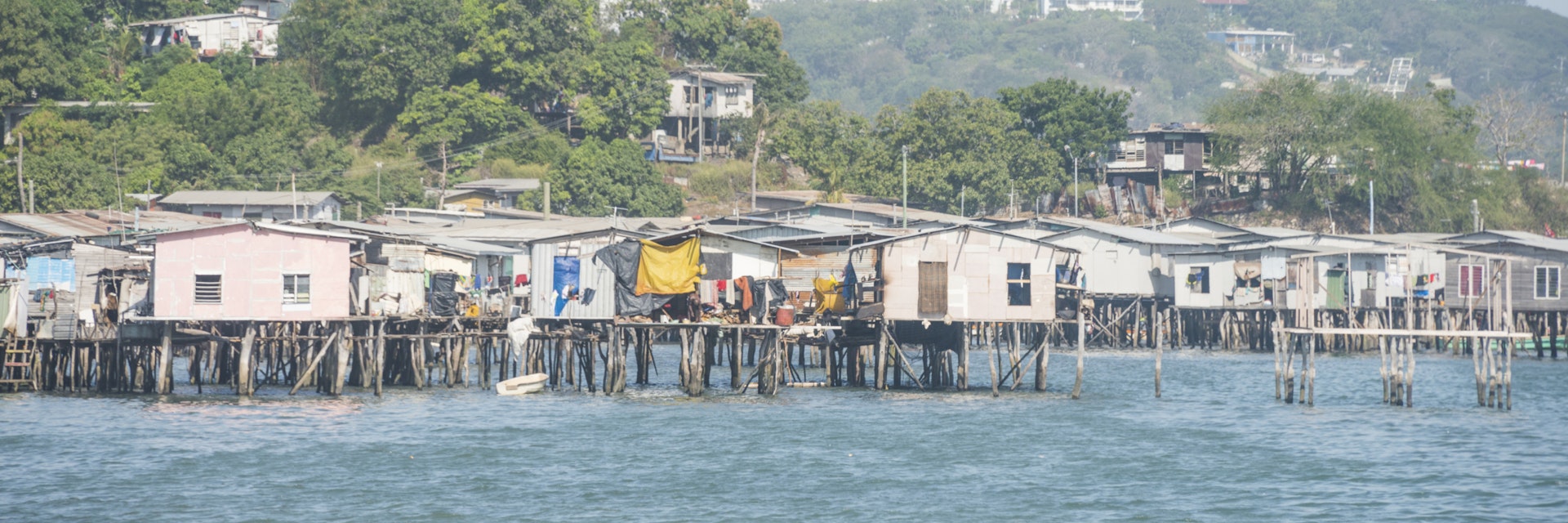
Past the docks to the north lies Hanuabada, the original Motu village. Although it is still built over the sea on stilts, the original wood and thatched…
Port Moresby
The Old Parliament Building was never an architectural wonder, but its opening as the House of Assembly in 1964 was a significant milestone on PNG's road…
Port Moresby
Some kilometres down the rough Kokoda Track road (barely navigable in a 2WD in the dry season only) is a turn-off left (west) back towards Port Moresby…

in partnership with getyourguide
Get to the heart of Port Moresby with one of our in-depth, award-winning guidebooks, covering maps, itineraries, and expert guidance.