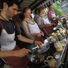
Having erupted from the Atlantic 30 million years ago, the sun-toasted Canary Islands host an irresistibly diverse clutch of protected landscapes, with soulful Tenerife leading the way thanks to its 43 designated natural areas.
The island’s volcanic origins have shaped an endlessly entrancing natural wonderland (49% of which is officially protected), where fragrant pine groves disappear into primeval laurel forests, terracotta-red volcanic cones emerge from desert-like plains and Atlantic waves roll onto glinting black-sand beaches.
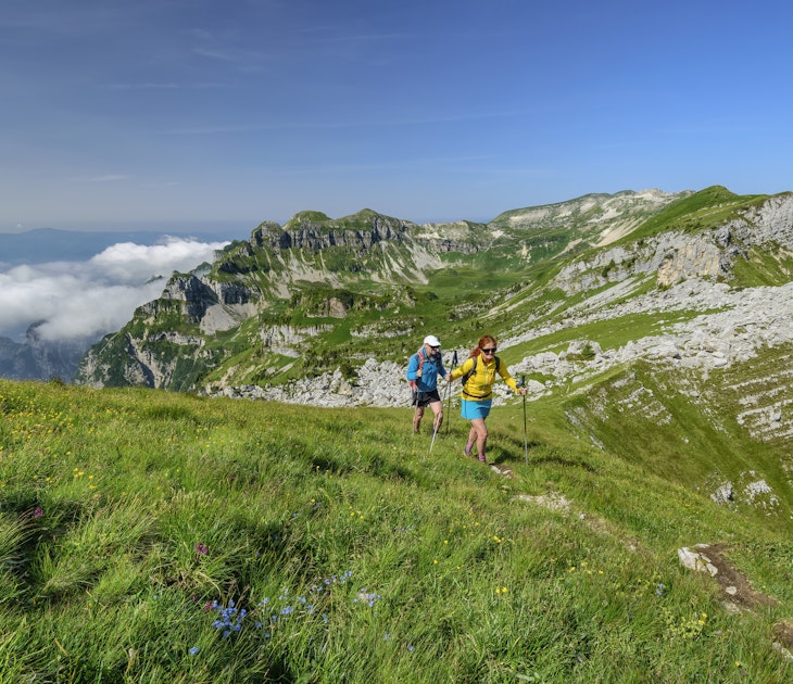
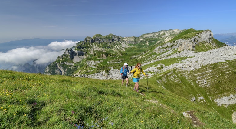
Back in the early 20th century, Spain was one of the first European countries to create a national parks system, and Tenerife’s staggeringly beautiful Parque Nacional del Teide emerged as one of the country’s earliest designations. Today, it’s Spain’s most-visited national park, with more than four million visitors arriving each year and 70,000 annual walkers clambering up to El Teide’s 3718m-high rim.
But Tenerife has plenty of other inspiring spaces where you can get out into the wild, whether you fancy hiking alone through banana-palm terraces, kayaking past plunging coastal cliffs or exploring eerily silent lava-sculpted moonscapes.
Recent years have seen a flurry of restrictions introduced to help preserve these fragile natural spaces in one of Spain’s top tourism destinations, with several popular spots bringing in a cap on daily visitor numbers and requiring pre-booked permits.
Parque Nacional del Teide
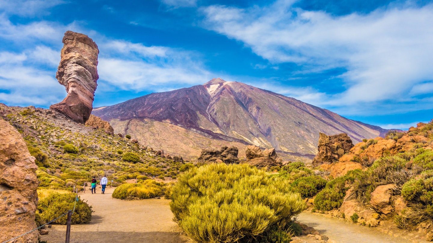
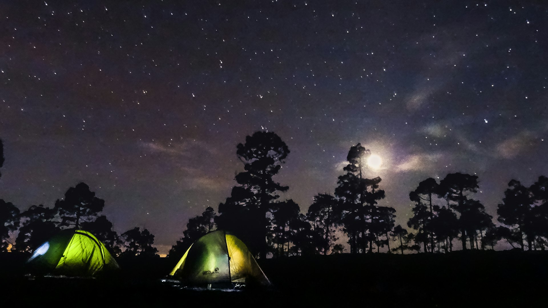
Spain’s tallest peak, El Teide is an unmissable magnet for lovers of the outdoors, looming 3718m (12,198ft) high over an almost-deserted volcanic valley at the heart of the island. All around it sprawls the hauntingly beautiful 190-sq-km (73 sq mile) Parque Nacional del Teide, declared a national park in 1954. A Unesco World Heritage Site since 2007, it has also been awarded Starlight Destination status for its gloriously clear night skies.
An easy-access cable car zips visitors most of the way up El Teide to 3555m (11,663ft), but if you want to walk the final 40 minutes to the summit (it’s five hours one way if you skip the cable car), you’ll need to book permits well in advance. Only 200 people are allowed to make the climb each day, with slots getting snapped up months ahead of time.
It’s also possible to summit both El Teide and its sister Pico Viejo (which last erupted in 1798) in a challenging full-day walk, and countless other trails wander across the volcanic cañadas (depressions) that surround the peaks and the much-photographed Roques de García. For the most inspiring scenery, time your visit for spring, when fresh floral blooms throw color against El Teide’s often-snow-dusted peak.
Encircling the national park, the 466-sq-km (180 sq mile) Parque Natural de la Corona Forestal protects a swirl of Canarian pine forests, whispering laurisilva (laurel forests), high-altitude gorges and sloping volcanic hillsides, with yet more rewarding hiking trails weaving across it, including the long-distance GR131.
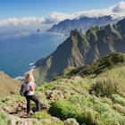
Parque Rural de Anaga
Tenerife’s rugged, mountainous northeast corner feels worlds away from Santa Cruz’s bustle and the Canaries’ beach vacation scene. In the serene Anaga mountains, mist-wrapped peaks disappear behind lush laurisilva forests, and spine-tingling hiking paths cling to the sheer slopes between steeply stacked valleys and remote pastel-painted agricultural villages. It’s all protected as the 144-sq-km (56 sq mile) Parque Rural de Anaga, which, along with 332 sq km (128 sq miles) of the surrounding ocean, was declared a Unesco Biosphere Reserve in 2015 for its astonishingly rich biodiversity. More than 2000 animal species roam its wilds, from small-white butterflies to endemic laurel pigeons. The two isolated outcrops just offshore, the Roques de Anaga, comprise a 25-acre Reserva Natural Integral, home to the world’s only population of giant Roque de Fuera lizards, as well as a wide range of migratory birds.
Among the 400km (249 miles) of walking trails threading through these deliciously peaceful hills, the 14km (9-mile) Afur-Taganana-Afur route (officially the PRTF8) is an unmissable star, tracking along soaring coastal cliffs to Playa de Tamadite, a tiny volcanic rock beach where cooling off in the Atlantic is pure bliss.
Malpaís de Güímar
Head out toward the Atlantic from the easygoing town of Güímar and you’ll be engulfed by east coast Tenerife’s otherworldly malpaís (badlands). Earthy-red sand, solidified lava waves and volcanic caves create a desert-like moonscape, with only hardy tabaiba plants, cardon cacti and Canarian lichens sprouting from fissures in the ground. This area has been a Reserva Natural Especial since the 1980s, and several thrilling hiking trails cross its lunar expanses, including a rewarding 6km (3.7-mile) loop from El Puertito de Güímar that takes about three hours.
Inland, don’t miss the six mysterious stepped lava stone pyramids known as the Pirámides de Güímar, whose origins still have archaeologists baffled by their similarities with ancient Maya architecture. Just south, the spectacular Barranco de Fasnia y Güímar gorge (declared a Monumento Natural) trickles down to the ocean, offering outstanding hiking and rappelling opportunities.
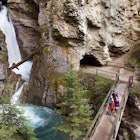
Barranco del Infierno
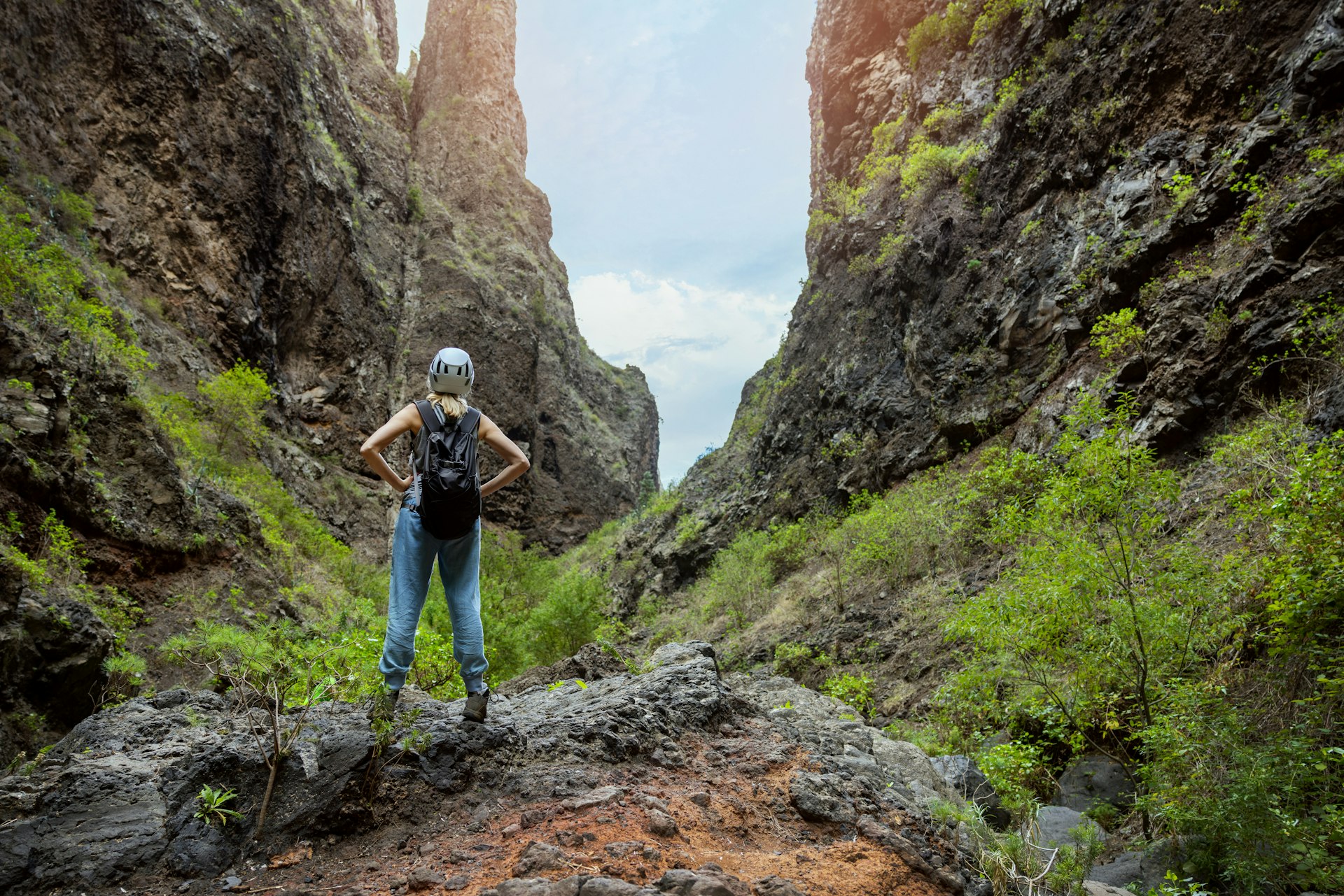
Just outside Adeje in sun-soaked southwest Tenerife, millennia of erosion have carved out the sheer-sided Barranco del Infierno gorge, where towering waterfalls give way to rare plant species such as drago trees, wild jasmine and cardoncillo (found only in the Canaries). Access is limited to only 300 people per day, and you’ll need a pre-arranged permit to tackle the three-hour (6.5km/4-mile) hike along the ravine, which climbs from 350m (1148ft) to 1300m (4265ft) high among the pine forests. You’re likely to spot kestrels, booted eagles and other birds of prey high above, and the entire surrounding landscape is a protected Reserva Natural Especial.
Montaña Roja
Known for its stark rust-red landscape, rich birdlife and unusual Canarian flora, this coast-hugging Reserva Natural Especial revolves around the 171m-high Montaña Roja volcano, on the edge of surf-loving El Médano on Tenerife’s south coast. Hike up to its wind-lashed peak for knockout wraparound views across sweeping beaches, rippling dunes and, on clear days, a distant El Teide.
The 2km (1.25-mile) trail is signposted from a parking lot off the TF643 road southwest of El Médano. Afterward, plunge into the deep-blue Atlantic at blissfully undeveloped Playa de la Tejita, hunt down a dome-shaped World War II bunker on the neighboring Montaña Bocinegro and soak up the kitesurfing vibes in El Médano, where Veinte 04 is a favorite hangout for live music, expertly mixed cocktails and eats made from local produce.
Parque Rural de Teno
The wonderfully wild, Atlantic-washed northwest tip of the island, Punta de Teno is a jagged volcanic rock peninsula with an irresistible pull. A 19th-century lighthouse keeps watch over the shoreline, and sunsets blaze orangey-pink across the endless ocean. To help with preservation efforts, access is tightly controlled. Private vehicles aren’t permitted during daylight hours and not at all on weekends, meaning the only way to visit is by hopping on a bicycle, taking a taxi or catching local bus 369 from Buenavista del Norte 10km (6.2 miles) away.
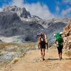
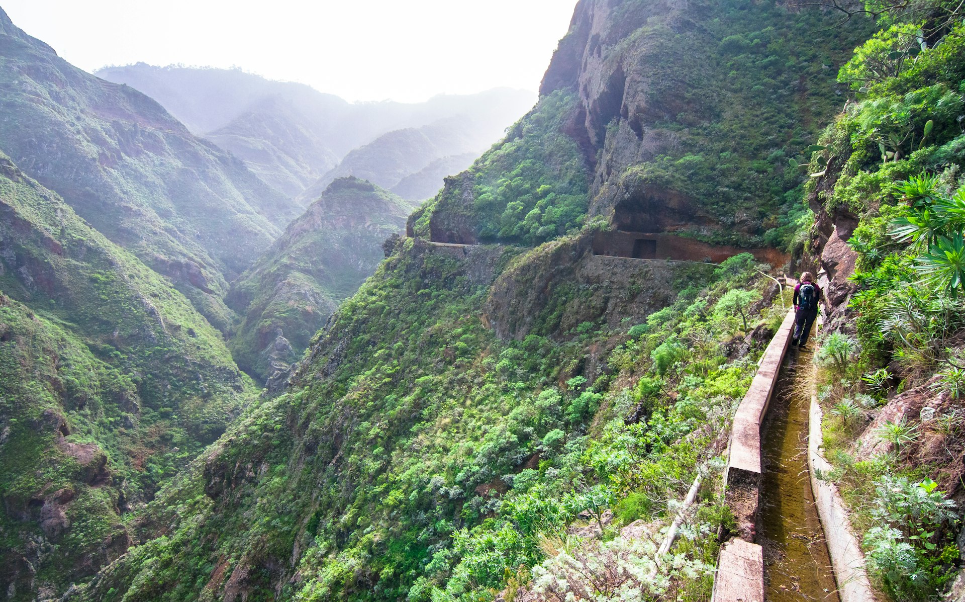
But Parque Rural de Teno takes in a whole lot more of Tenerife’s craggy northwest, including the staggering 600m-tall basalt cliffs of Los Gigantes (best admired from a bobbing kayak), a string of tricky-to-reach black-sand beaches and the precipitous Barranco de Masca ravine. A thrilling, vertiginous and deservedly popular 10km (6.2-mile) round-trip hike that takes about seven hours runs along the gorge between clifftop Masca village and the all-natural pebble-and-sand beauty of Playa de Masca. Reopened in 2021 after extensive restoration work, the route is accessible only on weekends, with just 125 daily walkers permitted. Pre-booking a permit is essential.