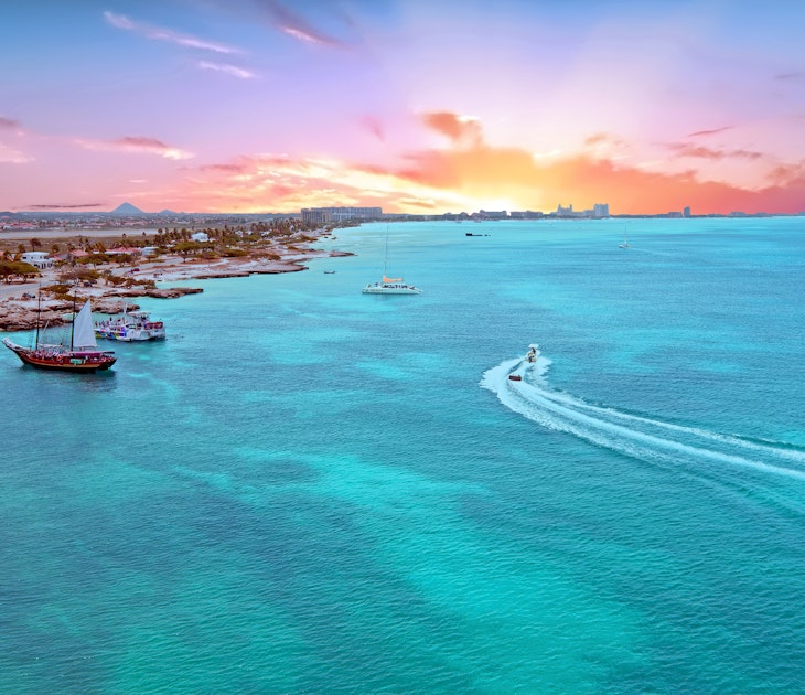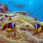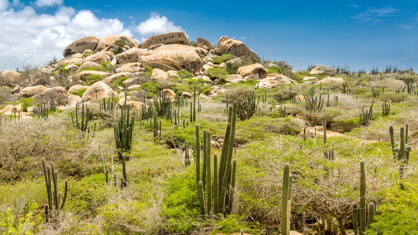
With sparkling Caribbean waves and glorious white sands, Aruba draws beach-lovers by the planeload, but there's more to this jewel of the Caribbean than the beaches. The island's fascinating desert interior lures travelers away from the sun umbrellas and out into a world of adventure.
Hikes here cross cactus-studded landscapes to stunning natural swimming holes and rocky peaks. To make the most of this exotic island, lace up a pair of comfortable shoes, grab some sun protection and a bottle of water, then make for these incredible hiking destinations in Aruba.

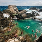
Conchi Natural Pool Trail
Best hike for dazzling views
7.7km (4.8 miles) round trip, 3 hours, easy
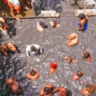
Aruba's normally smooth roads give way to a well-worn gravel trail en route to Conchi Natural Pool. Protected from the driving waves by a curtain of rocks, this rocky pool on a remote stretch of Aruba's eastern coast is far and away the most popular natural sight on the island. However, most visitors to the pool opt for the easy route – a bumpy 4WD track leading to a dirt parking lot near the entrance to the pool.
Those who hike here instead are rewarded for their efforts with views of the entire island as they pass through aisles of prickly pear cacti, catching glimpses of a plethora of other plants and wildlife. The trail begins at the Arikok National Park visitor center and snakes through the island's dry interior.
The latter portion of this hike follows the 4WD track, so it can be crowded with Jeeps and trucks. Get an early morning start to leave the bustle behind and enjoy the peace of one of the most isolated and beautiful locations in Aruba.
The best things to do in Aruba cover every kind of adventure
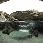
Daimara to Conchi Natural Pool
Best for a gentle hike
3.8km (2.4 miles) round trip, 1.5 hours, easy
This shorter, seaside route to Arikok National Park's famous natural pool serves up a gentle alternative to hiking over exposed desert peaks, with constant views of the shoreline and pockets of wildflowers as you stroll past the dunes at Daimari and the transfixing sands of Boca Keto beach.
Travelers will still find a line of eager swimmers waiting at Aruba’s most famous swimming hole but the journey from Daimara is typically less trafficked than the main trail to the natural pool. As a bonus, there are excellent bird-watching opportunities and plenty of places to wriggle your toes into the sand along the way.

Aruba's Northern Tip
Best hike for photo opportunities
4.1km (2.6 miles) round trip, 1 hour, easy
The historic California Lighthouse stands sentinel over a flat, dusty loop trail that winds around the northernmost tip of Aruba. This little-trafficked route traverses dirt roads, rocky shorelines and sand dunes, passing the occasional cactus, and it delivers breathtaking views of an unspoiled section of the island’s coast.
The shoreline north of Malmok is one of the least visited areas on the island. Most travelers stick to Arikok National Park or the beaches near Santa Cruz and Oranjestad, which makes the far north of Aruba an excellent place to soak up the peace and quiet.
This loop trail is also a perfect playground for photographers. Set out before dawn to take snaps of a glorious sunrise over the rocky shore at Westpunt or watch the sunset over the California Lighthouse from the Arashi Dunes.
Bushiribana Gold Mill Ruins Walk
Best hike for families
1.4km (0.9 miles) round trip, 35 minutes
In 1824, a young boy stumbled across a nugget of gold in the riverbed of Rooi Fluit, triggering a wave of mining activity that produced three fully operational gold mills at the peak of Aruba's short gold rush. Lingering remnants of this mad dash for cash still haunt the island’s northern coast in the form of windswept, sandstone ruins at Bushiribana.
A lightly trafficked loop trail leads to the site where gold mined all over the island was ferried by donkeys to the smelters. It's a short, kid-friendly outing that pairs nicely with a visit to the island’s ostrich farm, located not far from the trailhead.

Bushiribana to Calbas via Wariruri Bay
Best hike for a beach stop-off
7.2km (4.5 miles) roundtrip, 2.5 hours, easy
It's easy to extend a hike to the ruins at Bushiribana by trekking onward to the stone-backed cove at Wariruri Beach. This remote, no-frills beach is a hotspot for local surfers who gather to take advantage of the swells that form over a submerged reef. Situated beside a forest of cacti, Wariruri is a great spot for people-watching and photography as well as catching a wave.
A looping trail marked by white arrows connects the trailhead at Bushiribana Gold Mill with a second trailhead at Calbas, crossing a river lined with towering cacti and volcanic rock formations before depositing travelers back at the starting point.
Balashi Gold Mill Ruins
Best hike for ruins
2.9km (1.8 miles) round trip, 50 minutes, easy
Bushiribana isn’t the only place where you can see evidence of Aruba’s gold rush days. At Balashi, near the southwest end of the island, visitors can delve even deeper into the lucrative metal boom that fueled the island’s economy for nearly a century.
This Balashi mill opened in 1899, decades after its seaside cousin at Bushiribana. Balashi was intended to be a larger, more efficient gold-extraction works, but the mill was shuttered during World War I as spare parts and raw materials became scarce and never reopened.
A loop trail leads to the looming ruins at Balashi, meandering through the mangroves of the protected Spanish Lagoon area, where hikers are likely to catch a glimpse of the Caribbean parakeets that nest inside the reserve.
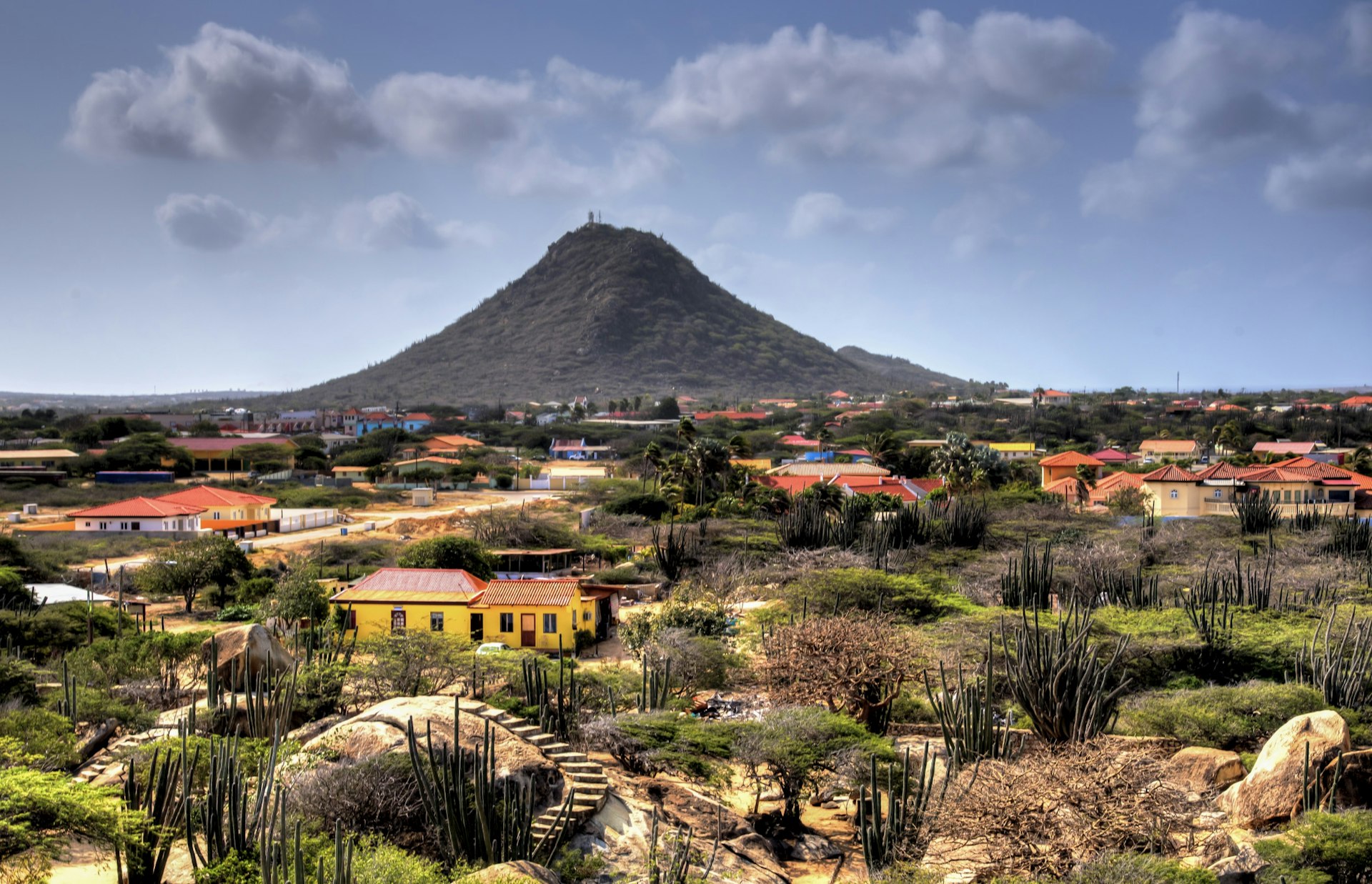
Hooiberg Trail
Best hike close to Oranjestad
1km (0.6 miles) round trip, 30 minutes, moderate
Most visitors to the iconic viewpoint atop Mt Hooiberg clamber up 91m (300ft) of painted concrete stairs for uplifting views over Oranjestad and Santa Cruz. However, the more adventurous can take an alternative route that leads away from the crowds.
Close to where the painted steps change color from grey to green, a diminutive red arrow points away from the path most traveled toward a rocky back route that allows hikers to scramble in peace to the summit. Marked with red dots and arrows, the trail passes through a landscape of cacti and wildflowers, with the occasional wandering goat.
Whichever way you come, the views from the top are stunning, taking in a sweep of Oranjestad suburbs and the distant coastline beyond.
Sero Jamanota to Fontein Cave and Dos Playa
Best hike for wildlife-spotting
13.6km (8.5 miles) round trip, 4.5 hours, moderate
The climb to the top of the highest peak on Aruba takes in artworks created more than a millennium ago by the Arawak people who inhabited Aruba in pre-Columbian times. This moderately difficult day-hike loop through Arikok National Park passes through a landscape that feels more like the deserts of the American Southwest than the tropical Caribbean, complete with wild donkeys, rattlesnakes, lizards and parakeets.
Expect to spend about 40 minutes trekking to reach the summit of 188m (616ft) Sero Jamanota before descending along a cacti-laden path to Fontein Cave. The Arawak drawings of insects, plants and local landmarks inside the cave were created at least 500 years before the "discovery" of the island by Europeans. Cap off the journey with a 2.5km (1.5-mile) jaunt to the pristine twin beaches of Dos Playa, where some of the island’s best surf awaits.
Travelers who’ve worked up an appetite can walk an additional mile to refuel at the Boca Prins Cafe before looping back to the parking area at Sero Jamanota.