If you’re in the mood for a challenging but rewarding hike, Phoenix is ready to deliver. The city boasts a variety of mountain trails that’ll have you scrambling over boulders, marveling at saguaros, and earning incredible views. Phoenix features over 200 miles of hiking trails, but these seven are among the most iconic mountain hikes in the city.
Before you set out, make sure that you’re taking the necessary safety precautions. Phoenix is a dry, desert climate, so bring plenty of water and a fully charged cellphone, and wear sunscreen and protective gear. And, of course, read up on these Phoenix peaks to decide which is suitable for you before hitting the trail — consider distances and elevation gains carefully, and only attempt hikes that you're confident you are physically capable of completing safely.
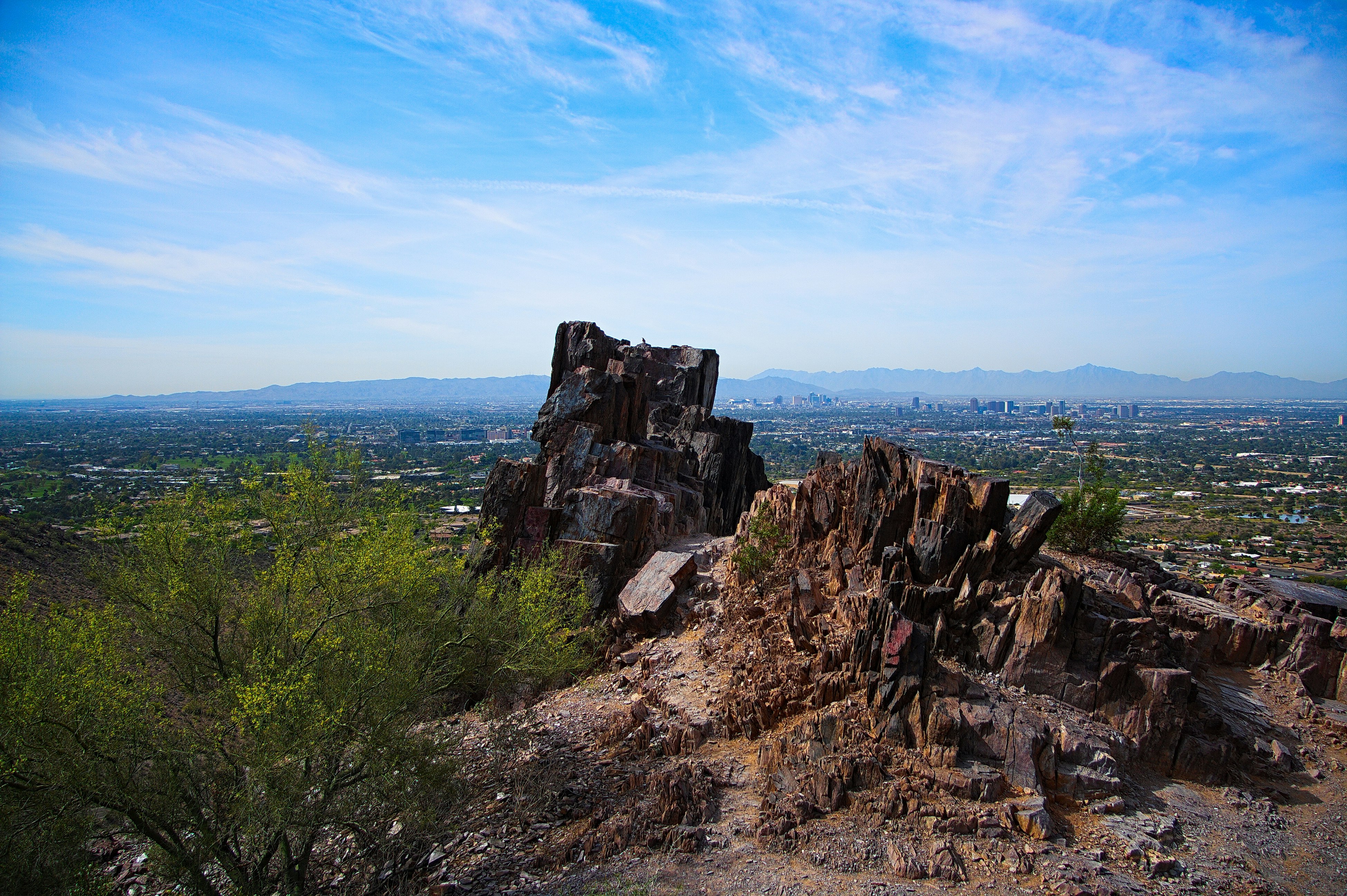
Piestewa Peak
Located smack dab in Central Phoenix, Piestewa Peak is the third highest peak in the city, at 2,610 feet. “The Stairmaster” is an apt nickname for the out-and-back Summit Trail, which climbs 1,200 feet in 1.2 miles. Be prepared for a trail that rises dramatically almost from the get-go and only levels off occasionally. The hike gets more intense closer to the summit, with metal handrails to guide you up the trail. At the very top, hikers scramble up a few rocks to reach the apex. Your reward for all the effort? Epic views of all of metropolitan Phoenix.
Camelback Mountain
Named after the shape it takes on the skyline, Camelback Mountain is the highest point in Phoenix at 2,704 feet. There are two popular trails on this mountain: Echo Canyon, and Cholla, although Cholla Trail is currently closed for renovation. Some consider Cholla the easier of the two but make no mistake, both trails are a challenge. Expect to get dusty and sweaty as you scramble to reach the top, ascending a staggering and heart-pumping 1,280 feet in 1.2 miles. The steep slope begins not far from the trailhead, with railroad ties used as steps that help hikers navigate the rocky terrain. After the seemingly endless climbing, the work pays off with stunning city views and a deep sense of satisfaction. Mind your footing on the way back down for a 2.5-mile hike.
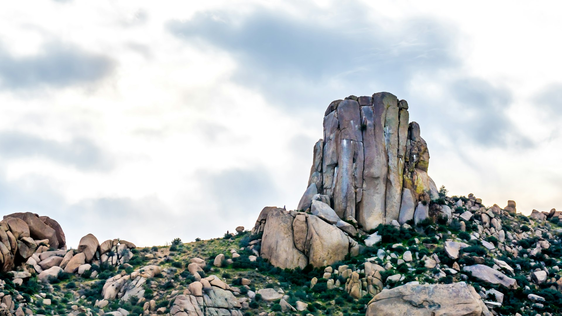
Tom’s Thumb
Located in the McDowell Mountains of Scottsdale, Tom’s Thumb was named after the first person to climb it, Arizona Mountaineering Club member Tom Kreuser. When you reach the end of the trail, you can’t miss the granite formation at the summit of this trail that looks like… yep, you guessed it: a thumb pointing toward the sky. Hikers will get an intense cardio workout as the trail ascends more than 1,300 feet in 2.5 miles. The stellar hike features switchbacks, scenic vistas, dramatic granite outcroppings, and desert flora and fauna. As you’re working up a sweat from start to finish, be sure to pause and take in the sweeping and stunning views of North Scottsdale and the surrounding area. The view from Tom’s thumb is particularly unforgettable. After enjoying the sights and a well-earned breather, simply hike out the way you came for a round-trip that’s about 5 miles.
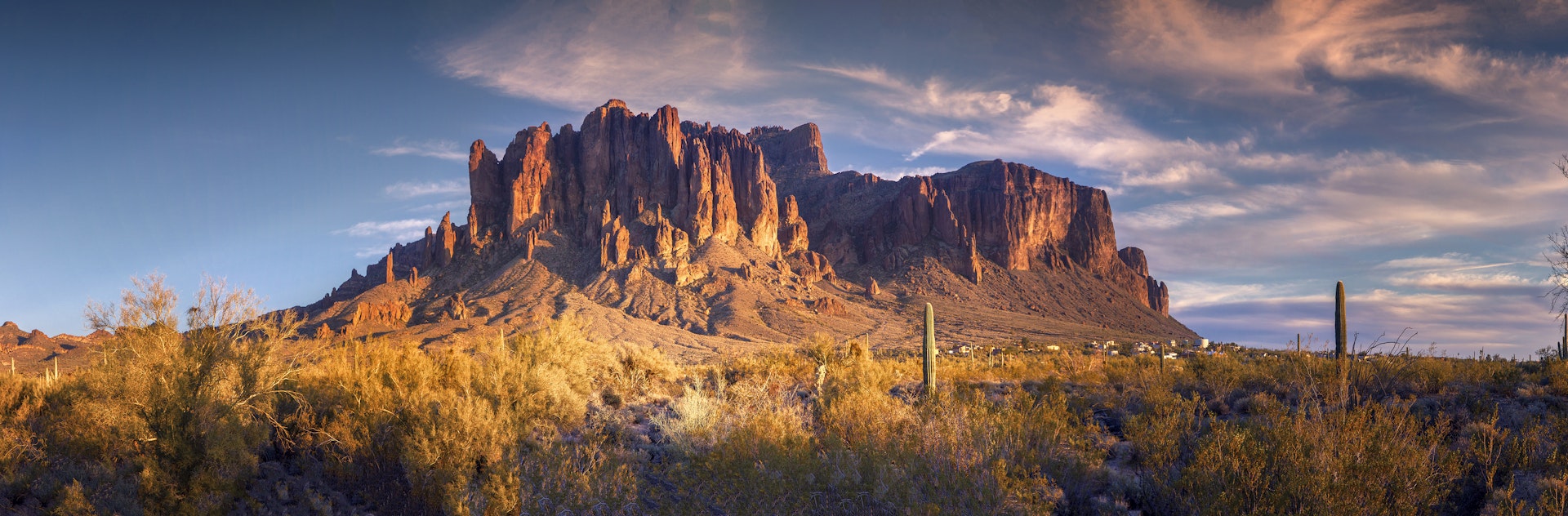
Siphon Draw to Flatiron Trail
About 40 miles south of Phoenix, the Flatiron Trail is a hike that is simultaneously iconic, challenging, and totally epic. Part of the Superstition Mountains (“the Supes,” to locals), Flatiron towers high at 4,861 feet. Hikers can anticipate a 2,750-foot elevation gain if they hike this out and back 6-mile journey. Begin your hike at the Siphon Draw trailhead in Lost Dutchman State Park. The hike from Siphon Draw will take you into a canyon of the same name. This trail is 4 miles round trip and offers plenty of scenic Sonoran desert vistas untouched by development. Many hikers will turn around at the end of the Siphon Draw Trail. If you’re up for a steep climb and have the experience and stamina, scramble up Flatiron, sticking to the left to stay on course. Before you reach the top, you’ll have to scale a (gulp) 12-foot wall to reach the summit. Once you’re there, relax, revel in your accomplishment, and take in breathtaking views of the Apache Junction area.
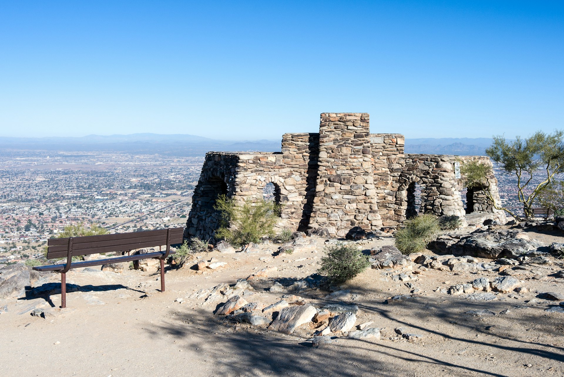
Shaw Butte Trail
Back in Central Phoenix, the Shaw Butte Trail in North Mountain Park is well-maintained and one of the easier mountain peak hikes in town. Parts of the trail are even paved, and it all kicks off at a well-developed visitors center. It’s relatively flat for the first mile, after which the course begins its reasonably steep climb. The trail dips and rises a few times before topping out at Shaw Butte, which stands high at 2,149 feet. At the summit, you can’t miss the radio towers and sweeping views of the Central Valley of the Sun. On your way back down, be sure to check out the concrete remnants of Cloud 9 Restaurant—a swanky spot that burned down in 1964—for a hike that’s around four miles total.
Holbert Trail
At more than 16,000 acres, South Mountain Park and Preserve is one the largest municipal parks in the entire country. Its Holbert Trail is one of the most popular hikes for one key and beautiful reason: Dobbins Overlook. Dobbins is the highest point in the park that is open to the public (at 2,330 feet), and it offers sweeping views of the entire Valley. By following this steep 2.5-mile hike that covers 1,100 vertical feet, hikers can reach this iconic viewpoint. Sure, you can drive to the top… but hiking the Holbert Trail and following the detour that leads to the Overlook is admittedly more rewarding. Once you’ve soaked up all the views, turn back the way you came – by the time you’ve returned to the trailhead, you’ll have hiked about 3.6 total miles.
Lookout Mountain Summit Trail
Lookout Mountain is a short peak hike that’s tucked away in a North Phoenix neighborhood, making it ideal for hikers who are short on time. Anticipate an elevation gain of about 400 feet in less than a mile. Near the summit, be prepared to do some scrambling on this mostly moderate trail. At the top, take in panoramic views of metro Phoenix before you head back down.