You can spend a lifetime hiking the parks, beaches, and wilderness in and around Santa Barbara. But even visitors on quick visits can easily pluck out some excellent options for many different routes in the area.
Whether you want an easy jaunt, a challenging trek, or something in between, you can find a hike for your taste. Choices include walks along the coast and beaches, as well as routes up into the mountains that take in waterfalls, gardens, and sublime views.
Santa Barbara Botanic Garden is the best accessible route for casual hikers
5.5 miles (9km) total, 2 hours, easy
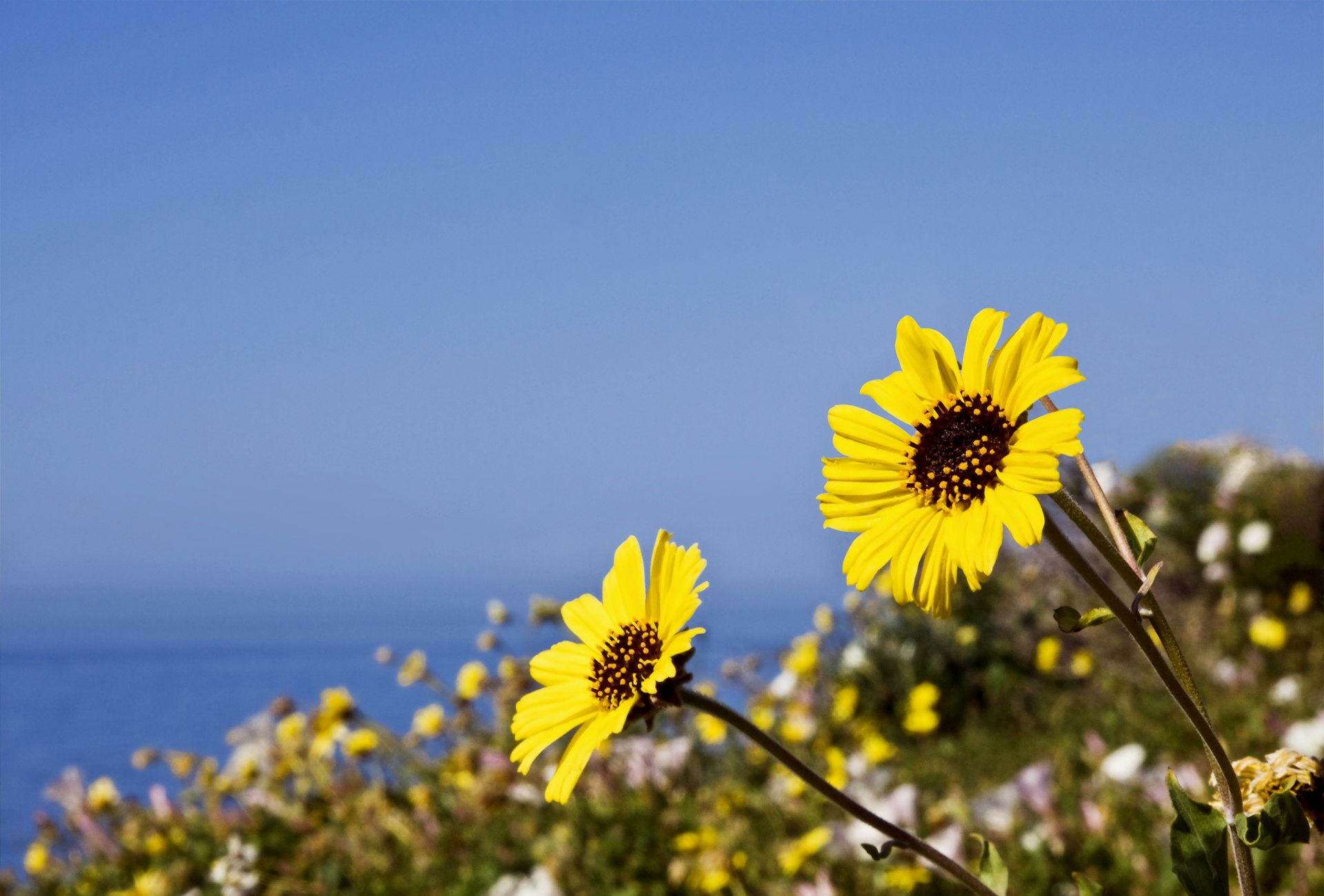
Garden lovers will be thrilled by the trails winding through gorgeous settings at the Santa Barbara Botanic Garden. Only three miles from the heart of the city, these nearly 100-year-old gardens cover 78 acres. They are laced with 5.5 miles of walking and hiking trails, all of which are very family friendly and are accessible to most people.
Over 1000 types of plants native to the region can be found in the carefully tended areas. In less than an hour, visitors can walk amidst coastal redwoods, meander through wildflower-covered meadows, smell wild sage amidst shady oaks, and much more. Don’t miss the Mission Dam, an 1806 legacy of a water feature built to serve Santa Barbara’s mission and which now has a seasonal waterfall. The manzanita section of the garden has more than 60 subtypes of the namesake type of tree found state-wide and prized for its brilliantly colored bark and ornamental value.
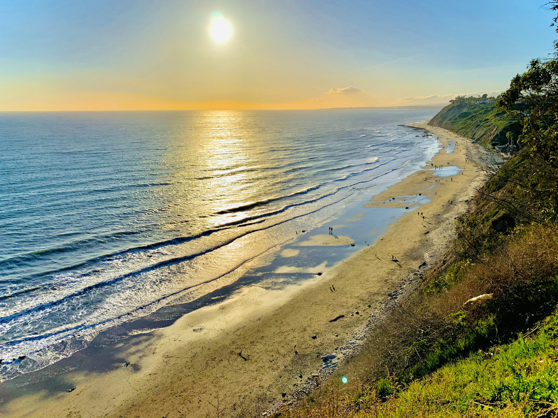
Arroyo Burro Beach is the loveliest coastal hike
1.3 miles (2km) round trip, 1–2 hours, easy
Head to the coast for this cliff-top jaunt that rewards with views across the Pacific Ocean as well as a visit to a lovely and wonderfully typical Santa Barbara beach right within the city limits.
Start in Douglas Family Preserve, a 70-acre park along a stretch of steep limestone cliffs. A looping trail follows the edge of the drop-off and affords views that will have you constantly stopping for a longer look. Throughout the year keep an eye out for migrating whales as well as dolphins, and seals. Breakers roll in across the ocean with metronomic regularity, and there are near-constant breezes, which inspire hang gliders.
Midway along the hike, the trail follows the edge of a canyon that leads down to Arroyo Burro Beach Park, which residents call Hendry’s Beach. It’s protected by the sweep of curving cliffs you’ve just traversed and is known for its fine, light sand. Best of all, a small cafe offers the perfect break after your adventure.
Gaviota State Park and Wind Caves is a top hike through the backcountry
5.7 miles (9.1km) round trip, 4 hours, moderate
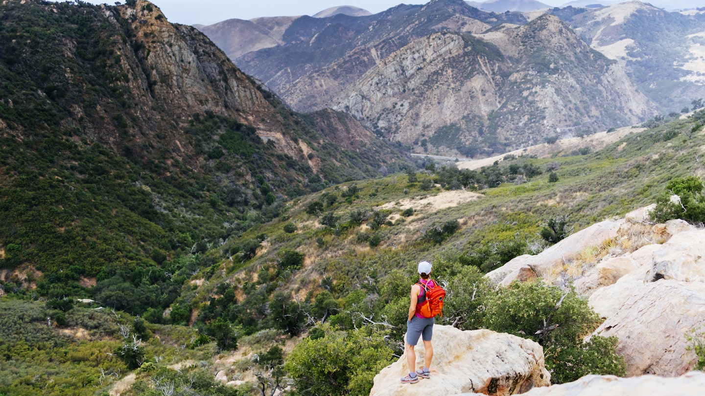
The wind whistles through ancient limestone caves on this hike that starts near a beach and ends in the hills of Gaviota State Park. The trail is a mix of pavement and dirt and ascends about 600ft into the untrammeled hills. Along the way, you’ll pass through typical seasonal Southern Grasslands, which are a rich burnt umber for much of the year except in spring when they are a vibrant green and the fields erupt in wildflowers.
There are also groves of oak trees scattered about. Watch for wildlife; although shy, you might catch a glimpse of a gray fox, coyote, or bobcat. Deer snooze during the day in the shadows. Pause for vistas far out to sea.
The hike is easily accessible west of Santa Barbara via Hwy 101. After your jaunt, relax at Gaviota Beach, which is sheltered on a wild stretch of coast and features the famous Gaviota trestle, a towering and historic railroad bridge.
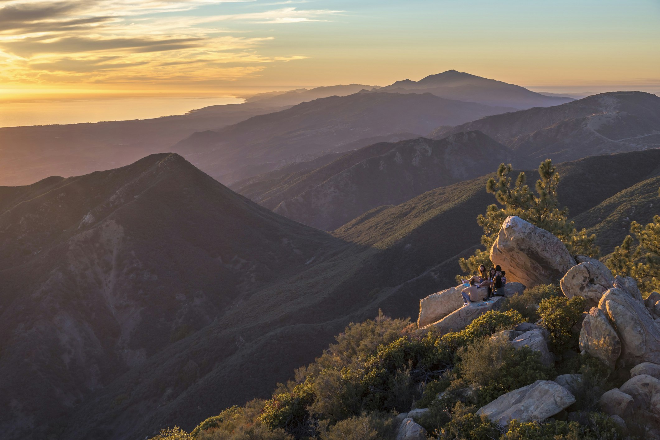
La Cumbre Peak is a good route for advanced hikers
16 miles (25.8km) round trip, 10 hours, hard
As one local hiker said, this is the trail for "those who want it all". Starting next to San Roque Creek in Stevens Park, this challenging hike traverses canyons and rock formations before summiting at the top of La Cumbre Peak (3986ft), the tallest mountain in the vicinity. A partial loop, the elevation gain across the entire route is over 4800ft. This is not for the casual rambler.
But for those ready to make the significant investment in time and energy, this day out will leave one feeling truly on top of the (local) world. The route surmounts several other notable peaks, including Arlington and Cathedral on the way to the final climb. As you’d guess, the views are varied and regularly stunning. Note that for much of the hike shade is non-existent, so bring protective gear and pack plenty of water – it can get very hot throughout the year.
Cold Spring Trail is the best hike for waterfalls and sweeping coastal views
2.7 miles (4.4km) round trip, 2–3 hours, moderate
Only 6.5 miles from downtown Santa Barbara are some of the region’s best views. On this looping trail, you enjoy sweeping vistas stretching along the entire Santa Barbara coast as far south as Ventura and west to the Channel Islands. And you’ll get great views into the heart of Los Padres National Forest, too. During winter and spring (if not other times), there's a series of clear, tree-shaded natural pools and small waterfalls, all fed by the trail’s namesake water source. Note that the "cold" in the name is significant as there are several hot springs in the vicinity (although, on weekends, these can become more party places than wilderness idylls).
The uphill portion of this route is a steady climb for the first half. In the tree-shaded portions of the trail, look for water lilies growing during the spring in the damper areas. In fall, watch for old, rogue apple and pear trees laden with fruit, survivors of a long-vanished farm here. The trailhead for this route is on E Mountain Dr.
Top tips: what you need to know about hiking near Santa Barbara
- Although Californians are inured to the state’s microclimates and sudden weather shifts – especially on the coast – visitors are often caught unawares. A perfect balmy day on the coast can suddenly turn cold and clammy when fog pours in, lowering temps by 25°F or more. Conversely, what seems like an idyllic day in Santa Barbara can turn scorching hot one ridge over inland. Bring layers and plenty of water.
- Across Southern California, trails and parks get very busy on weekends. If you can, opt for weekday hikes to avoid crowds and enjoy natural serenity.
- Stay aware of where you are. Hikers get complacent because they think they are in a developed area close to Santa Barbara. In reality, Los Padres National Forest, which covers the hills and mountains north of the city, regularly swallows up lost hikers. Disorientation amidst the steep and similar-looking terrain and spotty cell phone service makes it easy to lose your bearings.
- California’s wildfire season now stretches nearly year-round. Check for trail and park closures, both temporary and long-term before setting out.
You might also like:
The 14 best things to do in Santa Barbara
How to get around Santa Barbara: from the waterfront to wine country
When to visit Santa Barbara: the best weather and the liveliest events