An otherworldly testament to the mechanical determination of the gold hunt, Malakoff Diggins is a place to get lost on fern-lined trails and take in the raw beauty of a landscape recovering from brutal hydraulic mining. There is a mesmerizing ghost town here, with a barber shop, ice-cream parlor and saloon, abandoned and now frozen in time. Join a tour of the town at the museum or stay at the campground or in one of three humble miners' cabins.
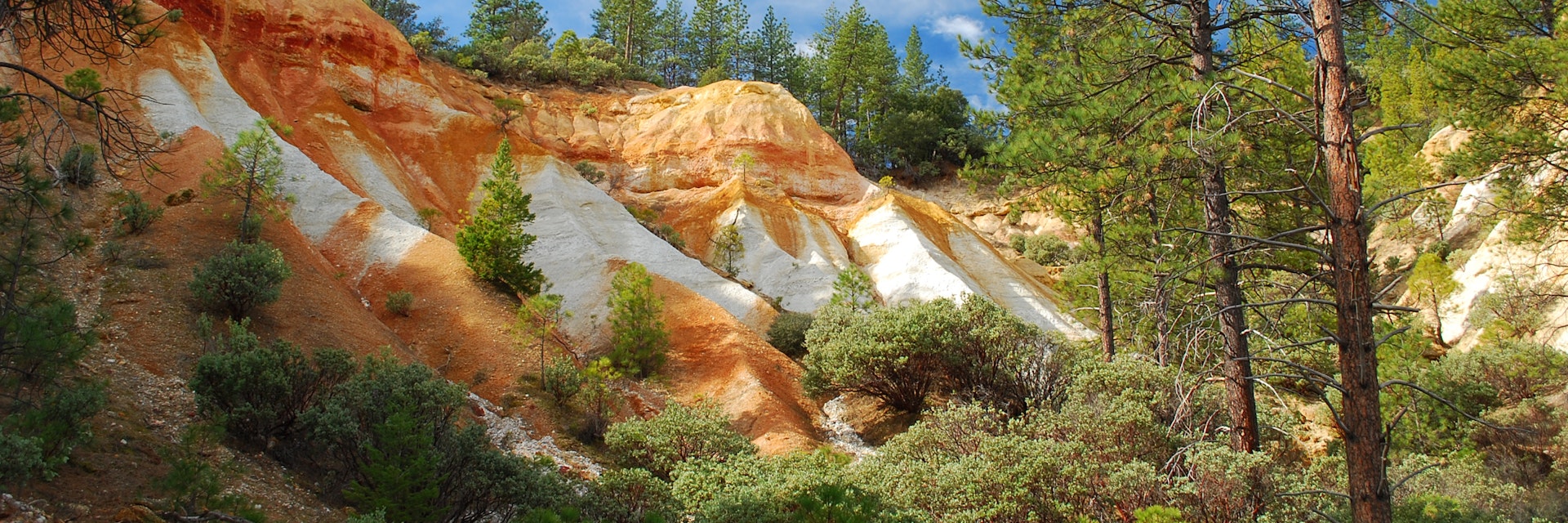
California's largest hydraulic mine left behind massive gold and crimson cliffs and small mountains of tailings, which were carved from the land by mighty streams of water. The forestland has recovered since the legal battles between mine owners and downstream farmers shut down the mine in 1884, and makes for a pleasant hike.
In 1852, a French miner named Anthony Chabot channeled the Yuba through a canvas hose to blast away at the bedrock. To reach the veins of gold inside, miners eventually carved a canyon 600ft deep. To speed up the sorting process, they mixed the slurry of gravel with quicksilver (mercury) to recover the gold, and then washed all the leftovers into the Yuba River. When a few decades later, 20ft high glaciers of tailings and toxic waste choked the rivers and caused deadly flooding, farmers and miners collided in the courtroom. In 1884, the Sawyer Decision set a critical precedent: a profitable industry can be stopped for the public good. No longer able to reap profits by dumping in the Yuba, most fortune hunters moved on. North Bloomfield, the mining community at the center of Malakoff’s operation, is the eerie ghost town that stands within the park’s limits.
Tours of the town – which had a population of 1229 back in 1880 – provide the chance to see some impressive gold nuggets. The 1-mile Diggins Loop Trail is the quickest way to get a glimpse of the scarred moonscape.
Access Tyler-Foote Crossing Rd, the turnoff for the park, 10 miles northwest of Nevada City on Hwy 49.
