Nathan Yan / Stocksy United
California
Twinkling cities, misty redwood forests, sun-kissed beaches, a creative local food scene and an adventurous attitude: California is instantly captivating.
Attractions
Must-see attractions

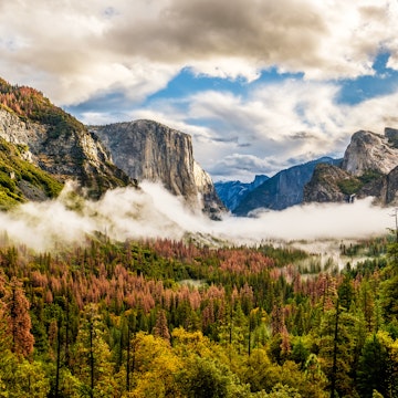
Yosemite & the Sierra Nevada
Yosemite means "killer" in the Indigenous Miwok language, and in today's parlance it's indeed an impressive, awesome site. Everywhere you look in Yosemite…

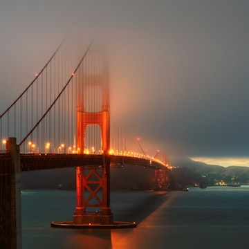
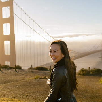
San Francisco
When Frederick Law Olmsted, architect of New York's Central Park, gazed in 1865 upon the plot of land San Francisco Mayor Frank McCoppin wanted to turn…
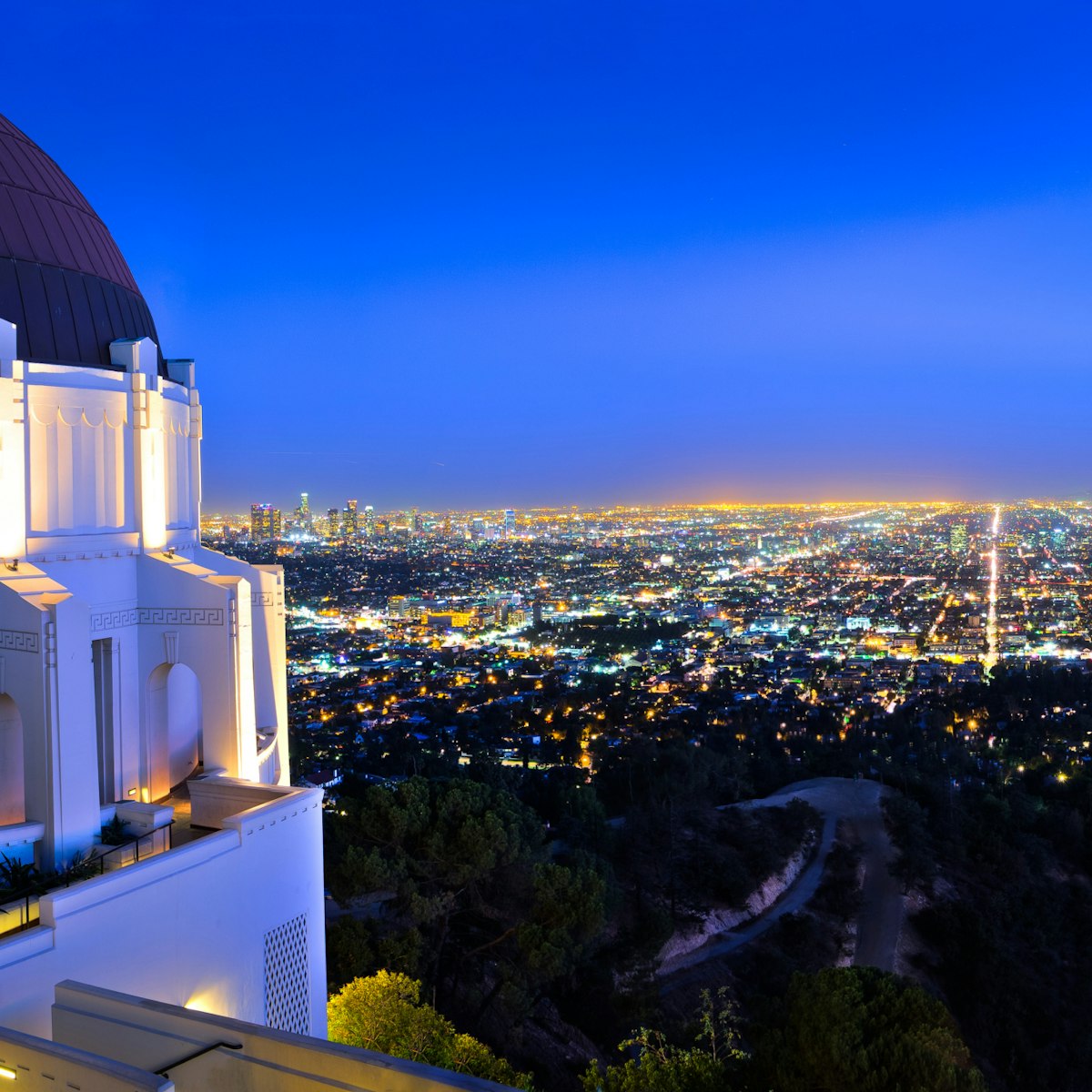
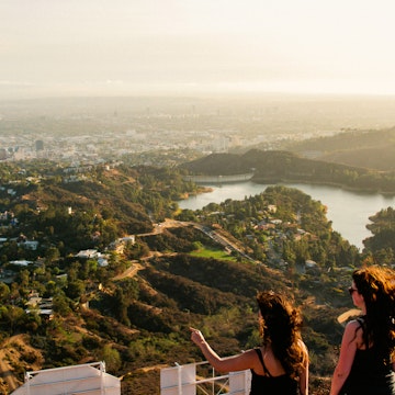
Los Feliz & Griffith Park
With eyes on both the galaxy above and palm-flanked boulevards below, the Griffith Observatory hovers above LA like a hulking spacecraft. This is one of…
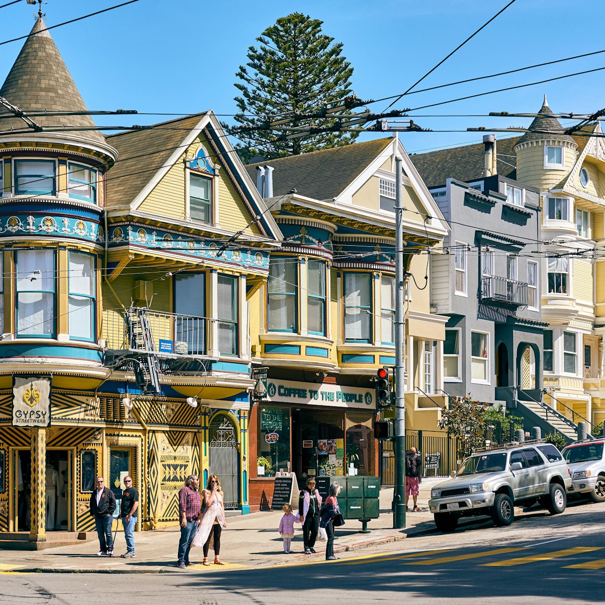
The Haight & Hayes Valley
Was it the fall of 1966 or the winter of ’67? As the Haight saying goes, if you can remember the Summer of Love, you probably weren’t here. The fog was…

North Beach & Chinatown
If you look close today at the clinker-brick buildings lining these narrow backstreets, past the temple balconies jutting out over bakeries, acupuncture…

North Beach & Chinatown
No one could have predicted the cultural force City Lights would become when it first opened in 1953. Sure, it had a proletarian ethos suggested by its…

San Francisco Museum of Modern Art
Downtown, Civic Center & SoMa
When the San Francisco Museum of Modern Art expanded in 2016, it was a mind-boggling feat that nearly tripled the institution's size to accommodate a…

North Beach & Chinatown
If you want to really see San Francisco, head to Coit Tower, a 1933 art deco beaut designed by Arthur Brown, Jr. and Henry Howard that sits high up on…
Attractions
Top picks from our travel experts

Central Coast
Between November and February, over 25,000 migratory monarch butterflies cluster in this thicket of tall eucalyptus trees, secreted inland. During peak…
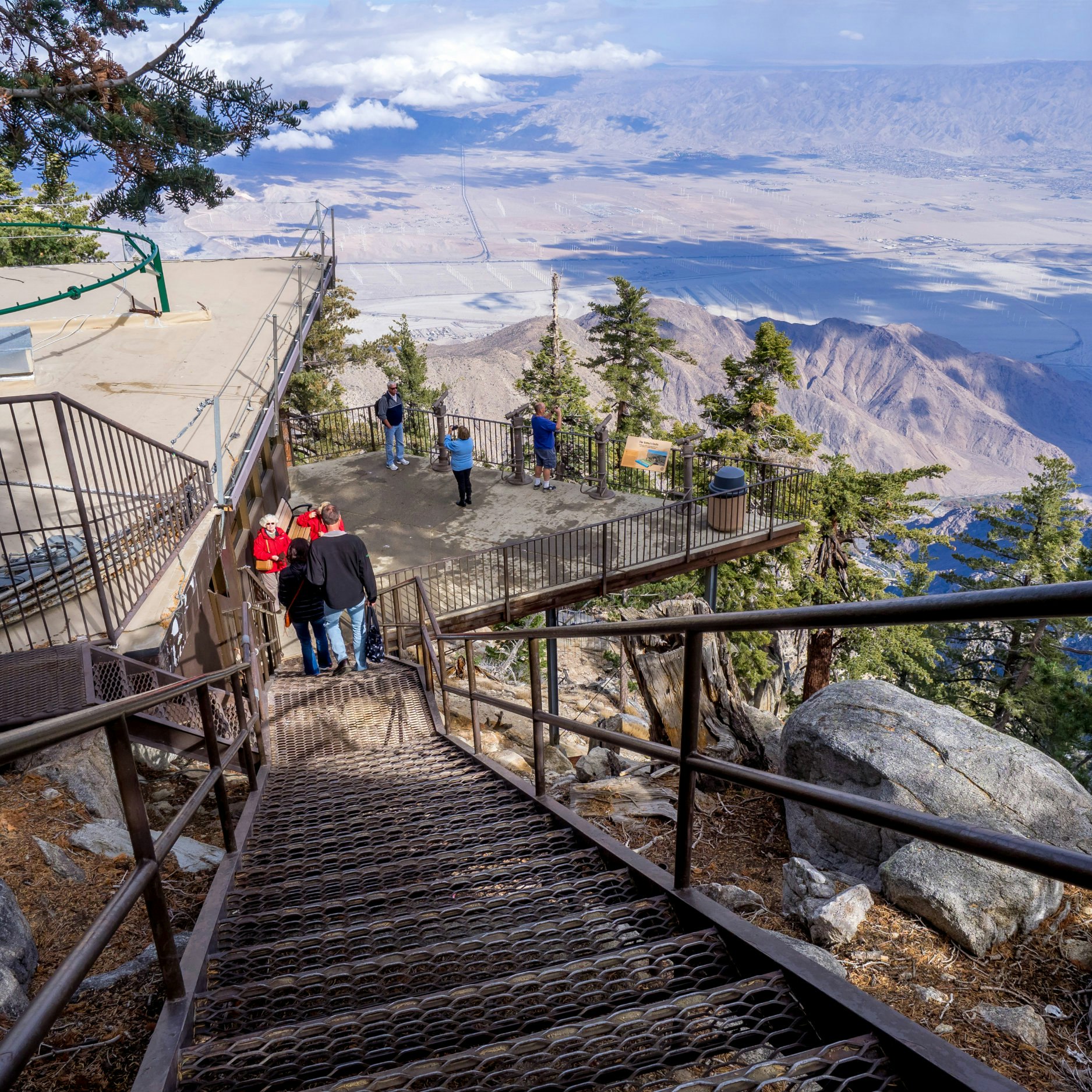
Greater Palm Springs
This rotating cable car climbs nearly 6000ft vertically and covers five different vegetation zones, from the Sonoran desert floor to pine-scented Mt San…
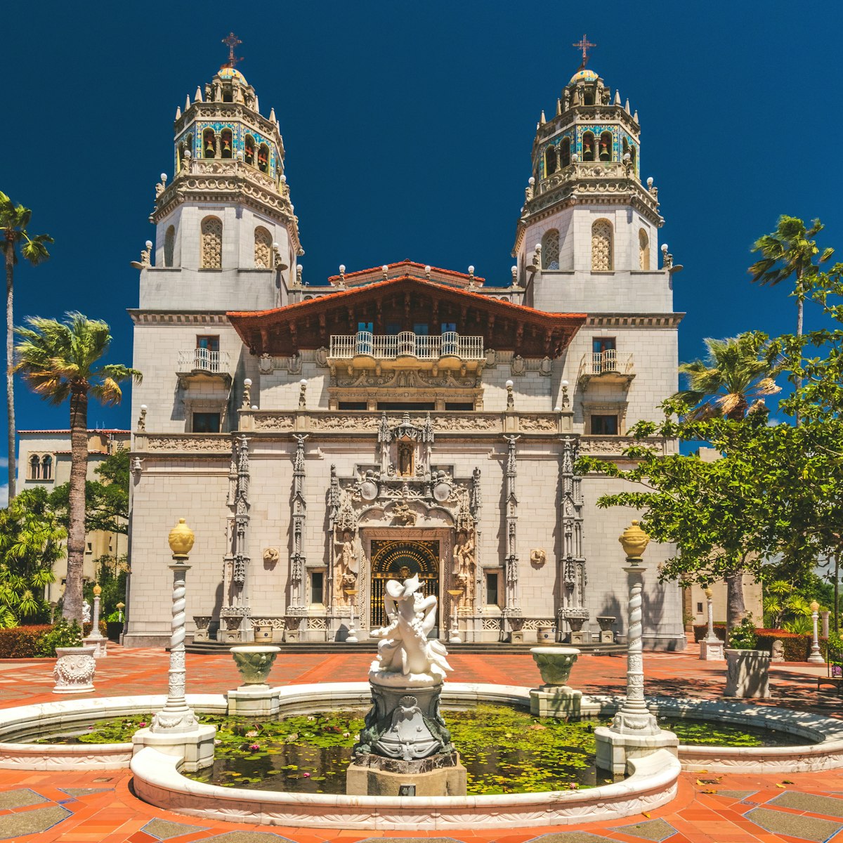
Central Coast
Perched high on a hill, Hearst Castle is a wondrous, historic, over-the-top homage to material excess. From the 1920s into the '40s, Hearst and Marion…
Chumash Painted Cave State Historic Park
Santa Barbara Wine Country
This tiny, off-the-beaten path historic site shelters pictographs painted by Chumash tribespeople over 400 years ago. The sandstone cave is protected from…
Cut-price California: the best free things to do in the Golden State
Curated by Lonely Planet Editors
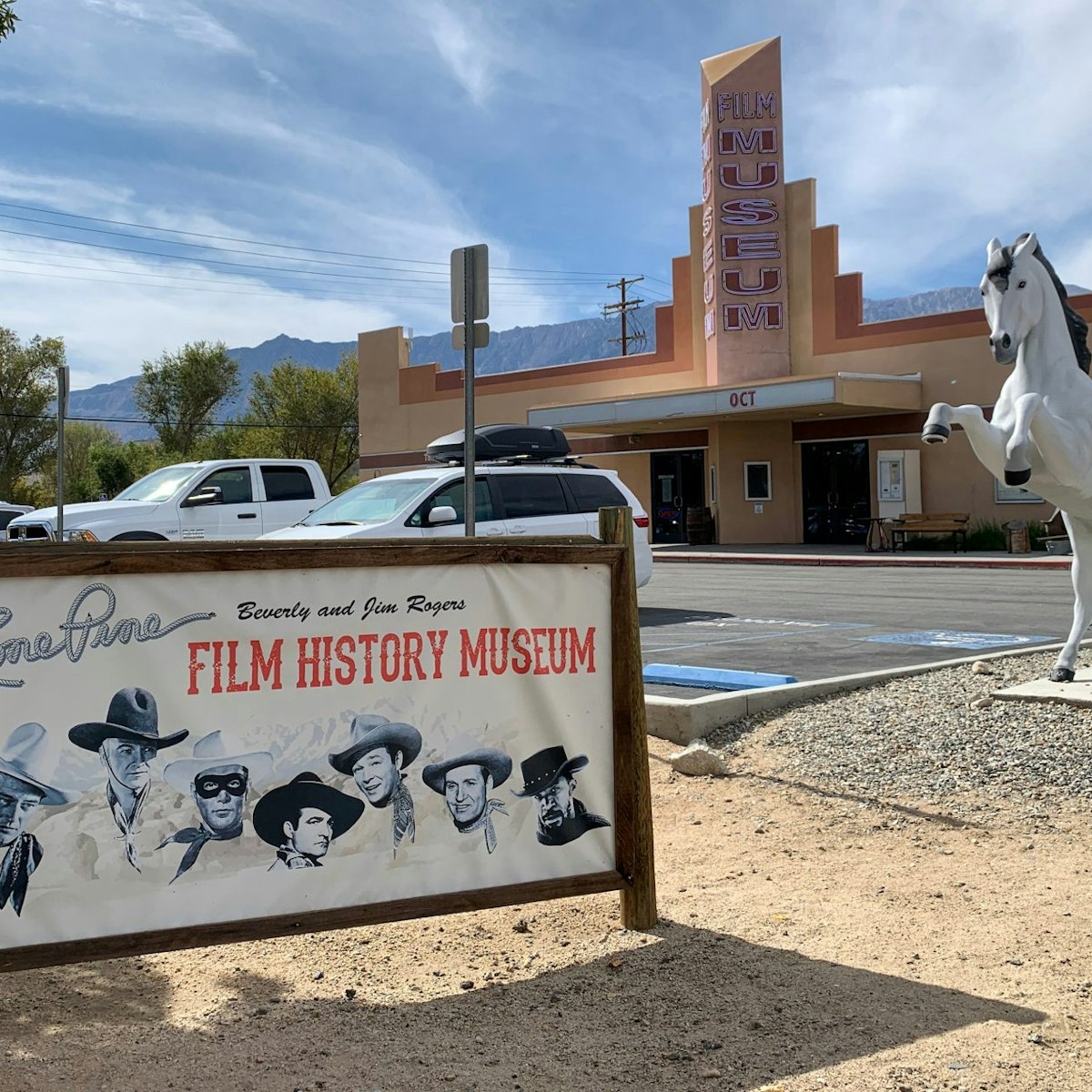
Museum of Western Film History
Lone Pine
More than 400 movies, not to mention numerous commercials (mostly for rugged SUVs and Jeeps), have been shot in the area. This fascinating museum contains…
North Coast & Redwoods
This park is the southernmost of a patchwork of state and federally administered lands under the umbrella of Redwood National & State Parks. After picking…
Marin County
This historical lighthouse is a breathtaking half-mile walk from Field Rd parking area. From the tip of Point Bonita, you can see the Golden Gate Bridge…
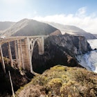
Big Sur
A little over 6 miles south of Bixby Bridge, Point Sur rises like a velvety green fortress out of the sea. It looks like an island, but is actually…
Big Sur
In the waters of Jade Cove in 1971, local divers recovered a 9000lb jade boulder that measured 8ft long and was valued at $180,000. People still comb the…
Napa
The former food museum beside Napa's famous Oxbow Public Market has been revived as a center of all things edible by the prestigious Culinary Institute of…
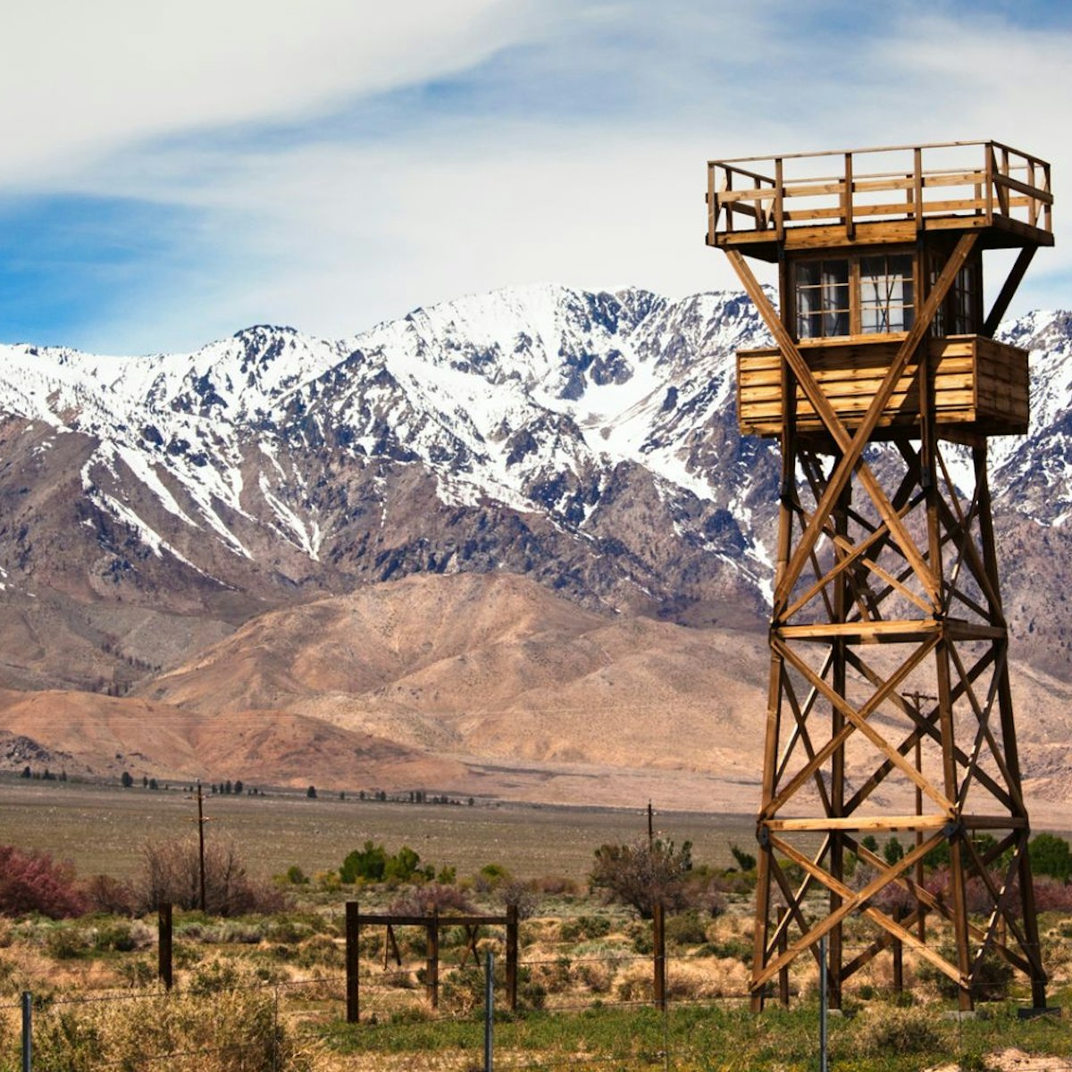
Manzanar National Historic Site
Eastern Sierra
A stark wooden guard tower alerts drivers to one of US history's darkest chapters, which unfolded on a barren, windy sweep of land some 5 miles south of…

Napa Valley
The pinnacle of California dining, Thomas Keller’s three-Michelin-star rated French Laundry is epic, a high-wattage culinary experience on par with the…
Marin County
With wild terrain and ferocious winds, this spot feels like the end of the earth and offers the best whale-watching along the coast. The lighthouse sits…
Russian River Area
Prepare to gawk and giggle at the wacky Patrick Amiot sculptures gracing front yards along Florence Ave. Fashioned from recycled materials, a hot-rodding…
Northern Mountains
Since 1978 the Wild Horse Sanctuary has been sheltering horses and burros that would otherwise have been destroyed. You can visit its humble visitors…
Redding & Around
On scale with the enormous natural features of the area, this colossal, 15-million-ton concrete dam is second only in size to Grand Coolie Dam in…
Anza-Borrego Desert State Park
The Deserts
The largest state park in California, Anza-Borrego comprises a staggering 640,000 acres of land punctuated with hiking trails, canyons, palm groves and…
Montgomery Woods State Natural Reserve
Along Highway 101
Two miles west of Orr Hot Springs, this 2743-acre reserve protects some of the best old-growth redwood groves within a day’s drive from San Francisco. A 2…
John Muir National Historic Site
East Bay
Naturalist John Muir's former residence sits in a pastoral patch of farmland in bustling, modern Martinez. Though Muir wrote of sauntering the Sierra…
Willow Creek China Flat Museum
North Coast & Redwoods
Pop over to this museum to take in its persuasive Bigfoot collection. Footprints, handprints, hair…it has all kinds of goodies to substantiate the ole boy…
Mammoth Lakes
Mammoth Mountain is the product of millions of years of volcanic activity, so it should be no surprise that the region surrounding it is full of…
Cesar E Chavez National Monument
San Joaquin Valley
This newly designated national monument, Nuestra Señora Reina de la Paz, is the national headquarters of the United Farmworkers of America and was the…
Along Highway 101
The Italian Graziano family is one of the oldest grape-growing families in Mendocino County and specializes in ‘Cal-Ital’ wines – including Primitivo,…
Planning Tools
Expert guidance to help you plan your trip
Best Things to Do
California has a reputation for sunshine, beaches and palm trees, but there's much more to see in the Golden State. Here are California's top things to do.
Read articleThings to Know
California's sun-drenched parks, beaches and cities are a huge draw for tourists but where to begin? Here's what you need to know before you go.
Read articleTransportation
California may be besotted with cars but that's not the only way to see the Golden State. Here's everything you need to know about getting around California.
Read articleMoney and Costs
California has a lot to offer travelers and unfortunately, the price tag to match. But there are ways to visit on a budget if you know how!
Read articleBest Road Trips
These ultimate California road trips take you from sea to mountains and through desert and redwoods.
Read articleArticles
Latest stories from California
Filter by interest:
Outdoors
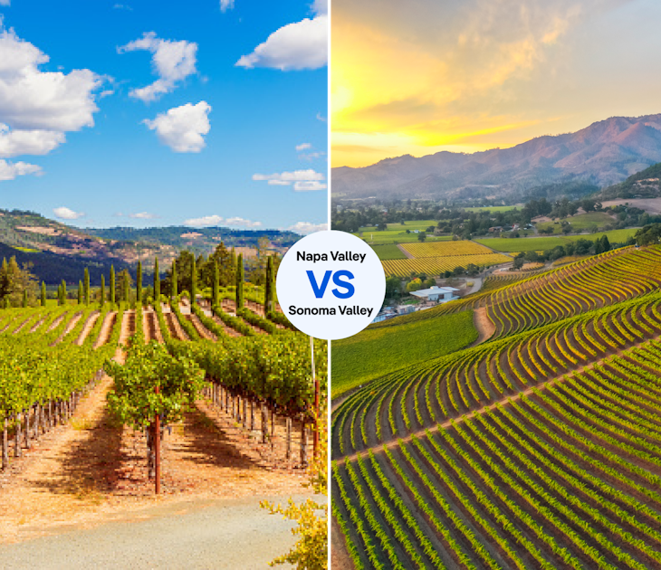
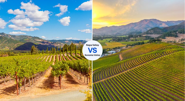
Napa or Sonoma: which California wine region offers superior sipping?Apr 29, 2024 • 7 min read
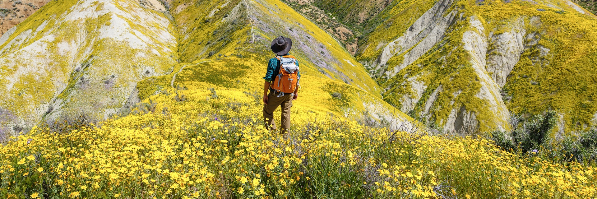
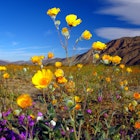 Wildlife & NatureCalifornia is set for an impressive super bloom season - here's where to see the wildflowers
Mar 13, 2024 • 3 min read

 Destination Practicalities11 things you need to know before visiting California
Sep 14, 2023 • 6 min read

 Destination PracticalitiesEverything you need to know about getting around California
Sep 14, 2023 • 11 min read

in partnership with getyourguide
Book popular activities in California
Guidebooks
Purchase our award-winning guidebooks
Get to the heart of California with one of our in-depth, award-winning guidebooks, covering maps, itineraries, and expert guidance.