Western El Salvador
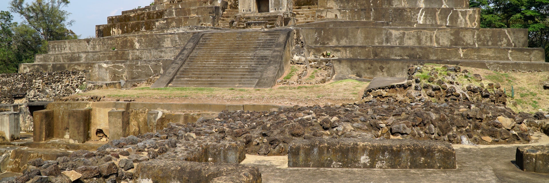
In the K’iche’ language Tazumal means ‘pyramid where the victims were burned.’ Archaeologists estimate that the verdant 10-sq-km Tazumal area – much of…
©erenmotion/Getty Images
Western El Salvador may be a small region, but it contains the majority of the country's attractions. The cloud forest and conical splendor of Parque Nacional Los Volcanes, the mysterious and at times unvisited Maya ruins at Tazumal, the Ruta de las Flores, and a volcanic lake are all within a 90-minute drive of Santa Ana, the charming provincial capital with the finest plaza in El Salvador.
Western El Salvador
In the K’iche’ language Tazumal means ‘pyramid where the victims were burned.’ Archaeologists estimate that the verdant 10-sq-km Tazumal area – much of…
Western El Salvador
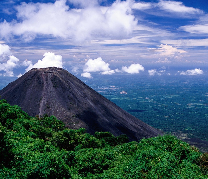
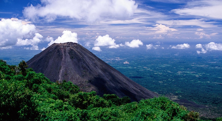
Alongside volcanoes in triplicate, Parque Nacional Los Volcanes has hectares of lush forest that provide sanctuary for hundreds of migrating bird species,…
Western El Salvador
Edging Guatemala, the mostly primary forest of Parque Nacional El Imposible shimmers with rivers and beautiful waterfalls. Hiking can get muddy and steep,…
Western El Salvador
The cloud forest–cloaked mountains of Parque Nacional Montecristo are home to abundant flora and fauna that make it a magnet for nature lovers and…
Western El Salvador
The most notable sight in Santa Ana is its large neo-Gothic cathedral, which was completed in 1913. Exquisite ornate moldings cover the church's front,…
Western El Salvador
The Teatro de Santa Ana is an opulent Renaissance-style building constructed using funds from an export tax on coffee beans. The epitome of wealth, excess…
Western El Salvador
Across the highway from Chalchuapa town center and the Tazumal site sits Casa Blanca, home to some Preclassic Maya ruins set in attractive woodland. An…
Western El Salvador
Metapán's town square features the glorious Iglesia de San Pedro, the jewel in a restored old quarter where the sense of civic pride is palpable. In the…
Filter by interest:
Get to the heart of Western El Salvador with one of our in-depth, award-winning guidebooks, covering maps, itineraries, and expert guidance.