In 2000 the former Mabuasehube-Gemsbok National Park was combined with South Africa’s former Kalahari Gemsbok National Park to create the new Kgalagadi Transfrontier Park. The result is a 28,400-sq-km bi-national park that is one of the largest and most pristine arid wilderness areas on the continent. The park is also the only place in Botswana where you’ll see the shifting sand dunes that many mistakenly believe to be typical of the Kalahari.
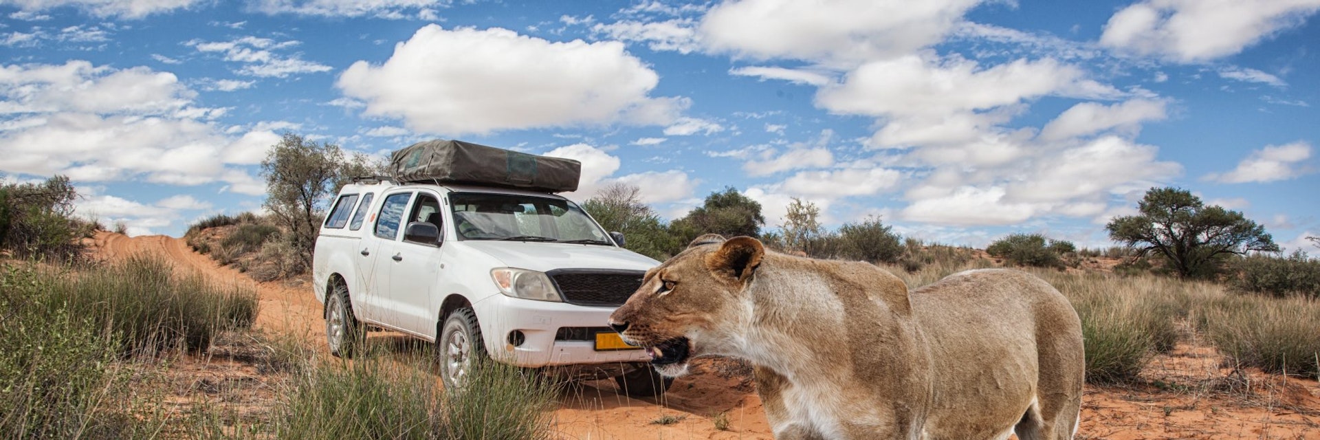
Kgalagadi is home to large herds of springboks, gemsboks, elands and wildebeest, as well as a full complement of predators, including lions (official estimates put the lion population of the park at around 450), cheetahs (200), leopards (100), brown hyenas (600) and spotted hyenas (375). More than 250 bird species are present, including several endemic species of larks and bustards.
Mabuasehube Section
The eastern Mabuasehube section covers 1800 sq km and is the easiest area of the park to access from the Botswana side of the border. Here, a series of salt pans, separated by classic Kalahari scrub vegetation, makes this section of the park a worthwhile destination in its own right. That said, if you restrict yourself to Mabuasehube and surrounding pans alone, you'll miss the exceptional breadth of Kalahari landscapes that is a feature of this park.
The two largest pans, Mpayathutlwa and Mabuasehube, are also the most beautiful, surrounded as they are by low hills from where there are some gorgeous views early in the morning or late in the day. There are 4WD trails that circumnavigate both pans. Mpayathutlwa Pan, 12km west of the park gate, has a waterhole at the northern end (some of the best views are to be found close to where the trail leads down the hill to the waterhole) and two appealing campsites on the western side. Mabuasehube Pan, around 10km north of Mpayathutlwa, is similarly superb, with marvellous views from all along the southern edge and parts of the eastern and western sides; the trail heads off into the bush at the northern end, but there is a fine lookout around halfway around. Mabuasehube Pan is used as a salt lick by migrating herds in late winter and early spring.
The other, smaller pans – Lesholoago, Monamodi and Bosobogolo – are also worth exploring. On the northern side of Khiding Pan, 11km west of Mabuasehube Pan, meerkats are a real possibility if you go quietly.
Two Rivers Section
Although you can reach the Two Rivers section from either Kaa or Mabuasehube, access is still easiest from South Africa. However you get here, the pools of rainwater that collect in the dry beds of the Auob and Nossob Rivers provide the best opportunities for wildlife viewing in the park. Here you'll also come across Kalahari dunes and camel thorn–dotted grasslands.
We recommend spending at least three days in this area of the park, slowly making your way back and forth along the riverbanks and dipping down to the river's edge where possible, but allowing time also for watching and waiting from the shadows as wildlife comes and goes. Look up also into the trees for horizontal branches that might just provide a vantage point for a sleeping leopard.
There's a lot of ground to cover – it's 161km from Two Rivers to Nossob, and a further 61km to Polentswa and this section offers the best wildlife watching - and that's just along the Nossob River. Over on the Auob River, it's 121km from Two Rivers to Mata Mata, which will take around 2½ hours, or even longer if you stop along the way, as you will in all likelihood. And don't neglect the trails that connect the two rivers – it is a little-known fact that lion prides thrive close to river confluences, and this is classic Kalahari lion country.
Getting There & Away
The Two Rivers Section is accessible from the south via Two Rivers and Twee Riverien and from the north via Kaa. Access to the Kalahari Gemsbok National Park is via Twee Rivieren. Both are about 53km north of the Bokspits border crossing. The border crossings to Namibia at Union’s End and Mata Mata are closed because traffic disturbs the wildlife.
To get to Mabuasehube Gate, most travellers coming from the Botswana side take the sealed road from Kang, southwest to Hukuntsi (108km). Just before Hukuntsi, a potholed road branches left (south) to Lokgwabe (11km). From Lokgwabe, an unsealed road (which was re-graded in 2016 but remains sandy in patches) runs south, then east, then south again for 136km to Mabuasehube Gate. The gate is signposted at various points along the way from Lokgwabe. Allow for three hours' driving from Kang to the gate.
To reach Kaa Gate from the Botswana side, make your way to Hukuntsi, pass through the town and take the reasonable unsealed road heading southwest. From Hukuntsi, it's 59km to the small settlement of Zutshwa then a further 73km to the gate. Mabuasehube Section is possible from the south (via Tshabong), north (via Tshane) and east (via Werda).
Getting Around
You’ll need your own 4WD vehicle for getting around the park, although some of the camps are accessible by 2WD.
Two 4WD trails connect the Two Rivers and Mabuasehube sections of the park, but only the southernmost of the two (which connects Nossob and Bosobogolo Pan, 171km away and 20km southwest of Mabuasehube Gate) is open to the public. The northern Mabuasehube Wilderness 4x4 Trail (155km) must be pre-booked through the DWNP in Gaborone or Maun.