Long-distance walking trails inspire a fascination, even obsession, in a certain type of traveler. While historically long walks were the default way of getting from one location to another, today’s walkers are drawn to multi-day treks for a variety of reasons: the epic physical challenge, spectacular scenery and wildlife, the chance to retrace the steps of past explorers, or simply a rare opportunity to experience peace and solitude.
While veterans speak of the trials and adventures of revered routes such as the Appalachian Trail, the Pacific Crest Trail or the Camino de Santiago, novices add these routes to their bucket lists, often planning an attempt to coincide with a major life milestone such as graduation, a sabbatical or retirement. Now a system of trails near Rio de Janiero add their snaking routes through Rio's varied landscape to the ranks.
How the Transcarioca Trail came to be
Pedro da Cunha e Menezes is a Brazilian hiking enthusiast who took his walking obsession to the next level. Inspired by a visit to the Appalachian Trail in 1995, Pedro dreamed of creating a long-distance hiking trail in his native Rio de Janeiro. As an accomplished mountaineer, he knew many of Rio’s walking routes from the ground, but it was his job as a flight attendant which led him to believe that these walking routes could be unified into a single long-distance walking trail.
On regular flights in and out of Rio, Pedro would gaze down over the city’s unique landscape of beaches, lagoons, forests and mountain peaks and imagine a grand walking trail to link them all. Now, more than 20 years after the original idea was conceived, and after countless hours of planning, meetings, trail clearing and marking, the Trilha Transcarioca (Transcarioca Trail) is open to the public.
The Trail
The trail’s name, Transcarioca, suggests crossing Rio de Janeiro (a ‘carioca’ is someone or something from Rio) and the route does just that, running 220.4km in an east-west direction. The trail, which can be walked in either direction, passes through 6 protected conservation areas, stretching from the wild beaches on the western outskirts of the city to the iconic Pão de Açúcar (Sugarloaf Mountain) on the eastern tip of affluent Zona Sul. Along the way walkers are treated to the very best scenery this spectacular city has to offer: a multitude of gasp-inducing lookout points, forests rich in wildlife, towering mountain peaks, secluded waterfalls, lagoons and a generous sprinkling of architectural and historical points of interest to boot.
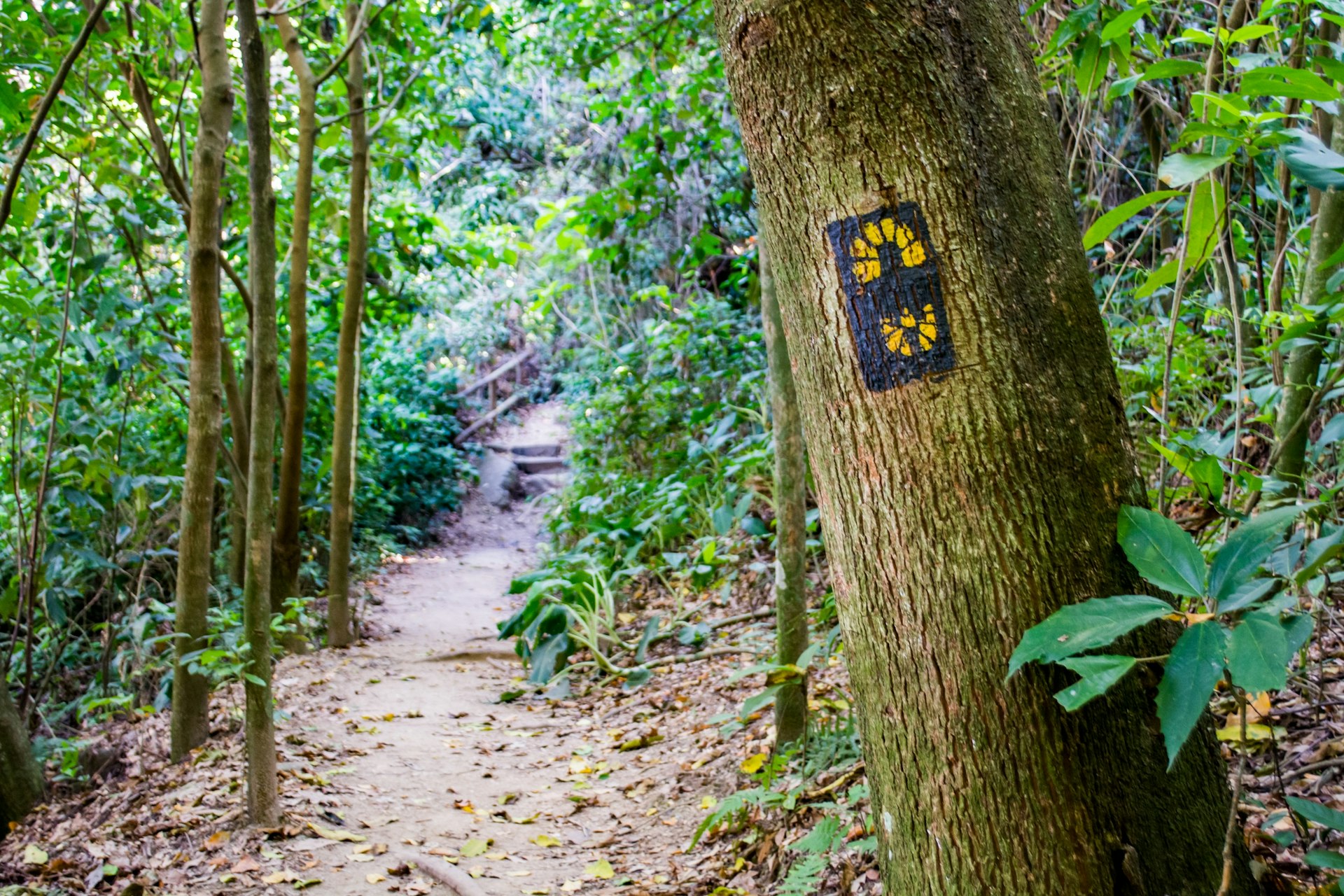
The trail is divided into 25 trechos (sections), each well-marked and rated for difficulty, elevation and trail safety. The sections range in length from 1.6-13.4km and most, if started early, can be completed by early afternoon. Although the trail can be attempted in its entirety, there are regular entry and exit points along the route so that smaller sections of the trail can be walked by those who don’t have the time or energy to walk the full trail.
The breakpoints between the sections have been positioned so that there are regular opportunities to leave the trail and reach accommodation – mainly hostels and campsites. This means that walkers with less time or stamina can select specific sections of the trail to be completed in a single day, while those who want to take on the trail in its entirety can plan overnight accommodation along the entire route of the trail. At the time of writing, the Transcarioca Trail organization is working on a list of approved trail accommodations that will be listed on their website.
The 6 parks
Guaratiba and Grumari:
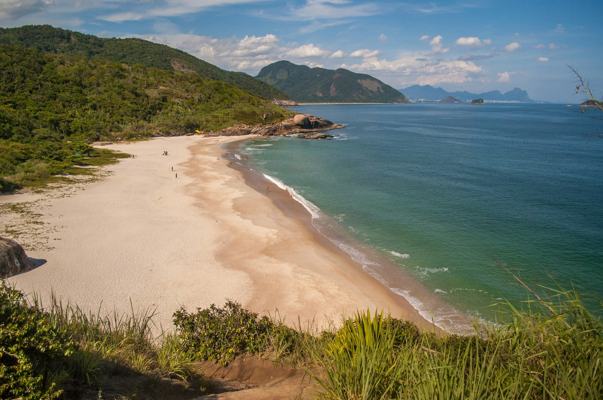
The first two stretches of the trek take walkers from the starting point in the coastal enclave of Barra de Guaratiba, past deserted beaches and interesting rock formations, northwards into the Grumari Natural Park. An optional side trip takes in the increasingly popular Telegraph Rock, where groups line up to take photos that appear to show the subjects hanging by their fingertips above a perilous drop (in fact the drop is just a couple of meters).
Pedra Branca State Park
The majority of the seven stretches inside the Pedra Branca State Park are rated difficult and involve steep climbs only suitable for fit and experienced walkers. Highlights include the spectacular Toca Grande lookout point and an optional side trip to climb Pico da Pedra Branca, the highest peak in the city.
Tijuca National Park
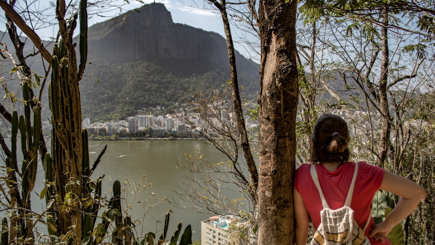
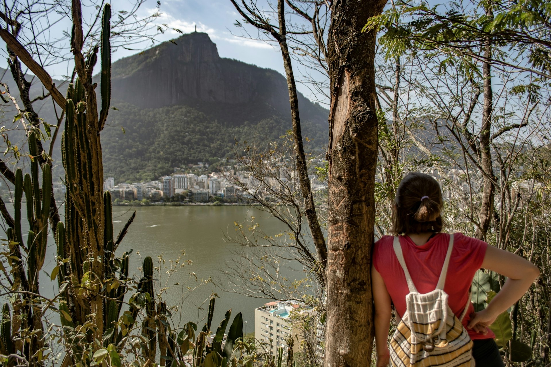
With nine trail sections covering a total of 45km, Tijuca National Park is the centerpiece of the Transcarioca Trail. These sections take in forest waterfalls, a steep climb to the Pica da Tijuca, the Christ the Redeemer statue and truly remarkable lookout points at Mesa do Imperador and Vista Chinesa.
Catacumba Park
Located on the side of Lagoa Rodrigo de Freitas, the Catacumba Park stretch of the trail includes two sections, one of which is closed at the time of writing. Despite this closure, the park still allows easy access to the fantastic Urubu and Sacopã lookout points.

Paisagem Carioca Park
This penultimate stretch of the trail takes you up into the hills above the heavily urbanized neighborhoods of Copacabana, Botafogo, Leme and Urca. The view from the Babilônia lookout point takes in the final sections of the trail, Praia Vermelha and Pão de Açúcar.
Morros do Pão de Açúcar e da Urca
The final stretch of the tour includes just a single section which is rated as easy and should take no more than an hour to walk. From Praia Vermelha the trail follows the paved path known as Pista Cláudio Coutinho and then turns sharply to the left for a short, steep climb to the summit of Morro da Urca, the lower of the two famous peaks that are conventionally reached by cable car. The views from the trail finishing point are fittingly impressive, though most walkers will choose to finish their journey by riding the cable car to the 396m Pão de Açúcar peak to enjoy spectacular 360° views of Rio and its surroundings.
Wildlife
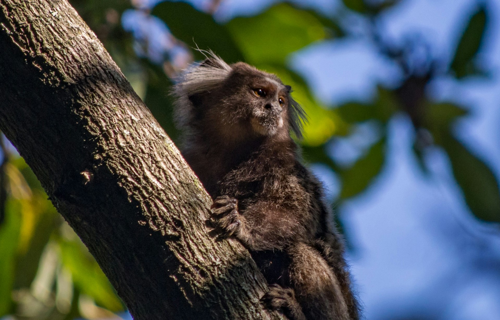
Rio de Janeiro lies within the remnants the Atlantic Forest. After centuries of deforestation, just 15% of the original forest coverage remains, yet the wooded areas and lagoons along the Transcarioca Trail still hold a wealth of wildlife. Marmosets and capuchin monkeys are easily spotted in the forested sections of the trail and while brown howler monkeys are less common, their howls can be heard from over a kilometer away. The forests are also home to sloths, coatis and opossums.
The birdlife in the forest is also diverse. Toucans, hummingbirds, parrots and black vultures are common, while a glimpse of the beautiful green-headed tanager will require sharp eyes and a bit of luck.
Security
Although the majority of trail sections have remained incident-free, there have been well-publicised incidents of groups of walkers being robbed while out on the trail. At the time of writing, section 19, which runs between Corcovado and Parque Lage, is considered the riskiest. As well as taking general, common sense precautions (such as keeping valuables out of sight), walkers should check with trail offices or local guides for up to date information before setting out on a trail.
Preparation and Precautions
Even if attempting just a short section of the trail, it is important that walkers make the basic preparations for a hike. Check the weather forecast, pack the necessary supplies (drinking water, food, sun block, insect repellent, etc) and seek out advice from park offices or local guides before setting off. Do not attempt to walk the trail alone or at night.
Useful links and information
For the Transcarioca Trail official website: trilhatranscarioca.com.br
Trancarioca Trail Facebook page: facebook.com/TrilhaTranscarioca
A Trilha Transcarioca app is available for iOS and Android devices. This includes maps, trail information and park manager contact phone numbers for each section of the trail.