It's time to spread out. Avoiding over-touristed destinations isn’t just about steering clear of crowds – it’s also about ensuring that we’re not contributing to the problem and instead helping to support the livelihoods of people in less-trafficked regions.
Truly getting off the beaten path, though? It can feel harder than ever, with phrases like “hidden gem” and “local secret” increasingly overwrought.
That’s why we asked our writers for their favorite under-the-radar haunts. They responded – some with regions and national parks that you’ve likely never heard of and many more with cities and states that you’ve probably never considered visiting.
The result is Lonely Planet’s latest title, Offbeat North America. The book celebrates 100 of the continent’s most underrated destinations, including the wilds of Alaska’s remote Dalton Highway and Mayan ruins hidden on the tip of Mexico’s Yucatán Peninsula. North America, as it turns out, still has plenty of secrets that remain untold.
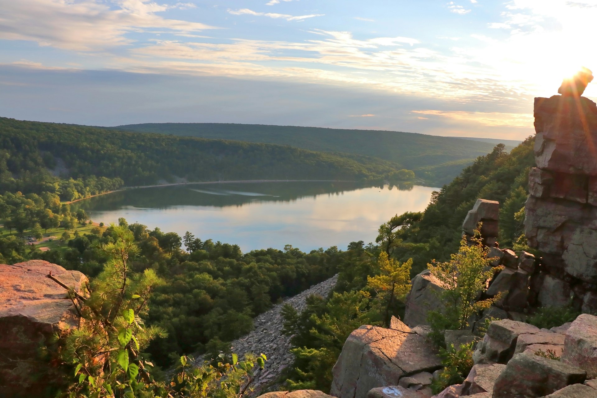
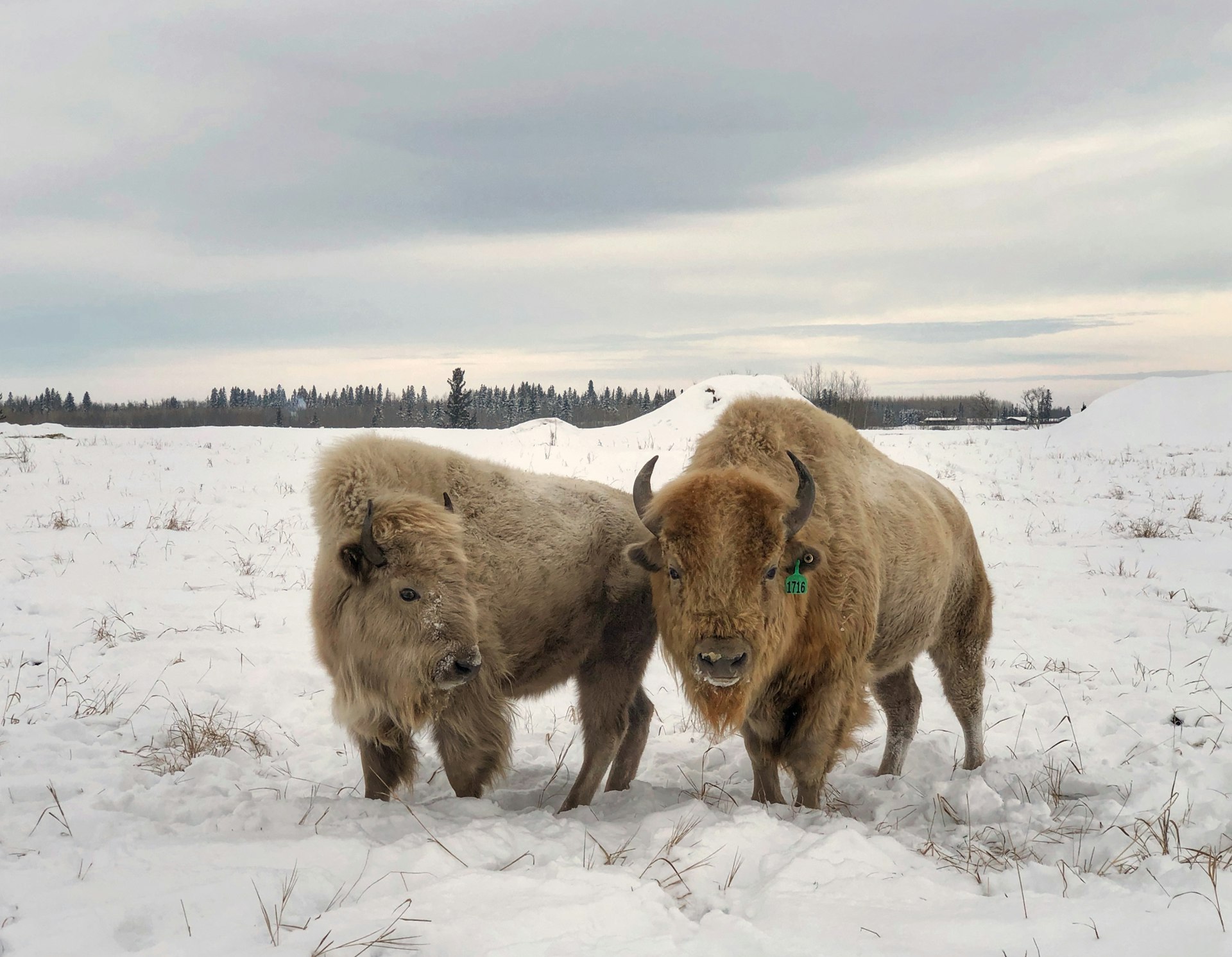
The place I personally couldn’t wait to write about was Grasslands National Park in southern Saskatchewan. While Banff National Park gets all the glory and over four million visitors per year thanks to its obvious good looks, Grasslands is home to one of the world’s rarest ecosystems: mixed-grass prairies. Sure, it might not have Banff’s glaciers or sublime blue lakes, but the waving grasses, roaming bison and chirping prairie dogs all lend to a sublime kind of beauty – one that only about 20,000 visitors per year will experience.
If you’re looking for more crowd-free alternatives to some of North America’s most popular vacation spots, here are just eight of the book’s entries, each highlighting how vast and varied our continent truly is.
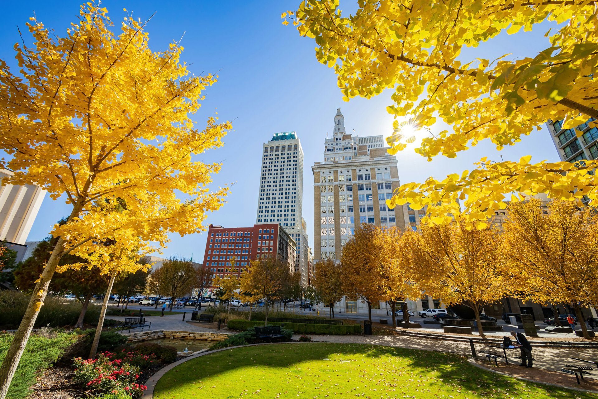
1. Tulsa, Oklahoma
Make this charming midwestern city your next city break
Propose a “city break,” and you’ll inevitably be presented with the same tried-and-true options, with cosmopolitan heavyweights like New York, Montréal, Los Angeles and New Orleans being the top competitors. But we have an unlikely contender to add to the ring: Tulsa, Oklahoma.
For over 100 years, its primary industry has been oil, the profits from which have played a major role in shaping Tulsa into a vibrant Midwest city worthy of your next long weekend. Take, for example, its extensive collection of lavishly built Art Deco buildings, dating back to the 1920s. Then there’s Tulsa’s well-funded art and cultural institutions. Museums like the Philbrook and Gilcrease stack up against those found in bigger cities, while new additions include the Greenwood Rising museum (which examines the 1921 race-based attack on the city’s “Black Wall Street”), the Woody Guthrie Center and the new-in-2022 Bob Dylan Center. It’s all rounded out by a lively music scene (concert venues include Cain’s Ballroom, a car-garage-turned-venue), craft breweries and excellent walking tours of its historic neighborhoods.
Getting there: Tulsa International Airport is the city’s main gateway, with nonstop flights from several US destinations. To explore, the city is best navigated by foot, rideshare or bikeshare.
When to go: September to November, when Tulsa’s weather is at its most temperate.
Pro tip: For a deep dive into Tulsa’s historic neighborhoods or its Art Deco architecture, book a customized walking tour with Tours of Tulsa.
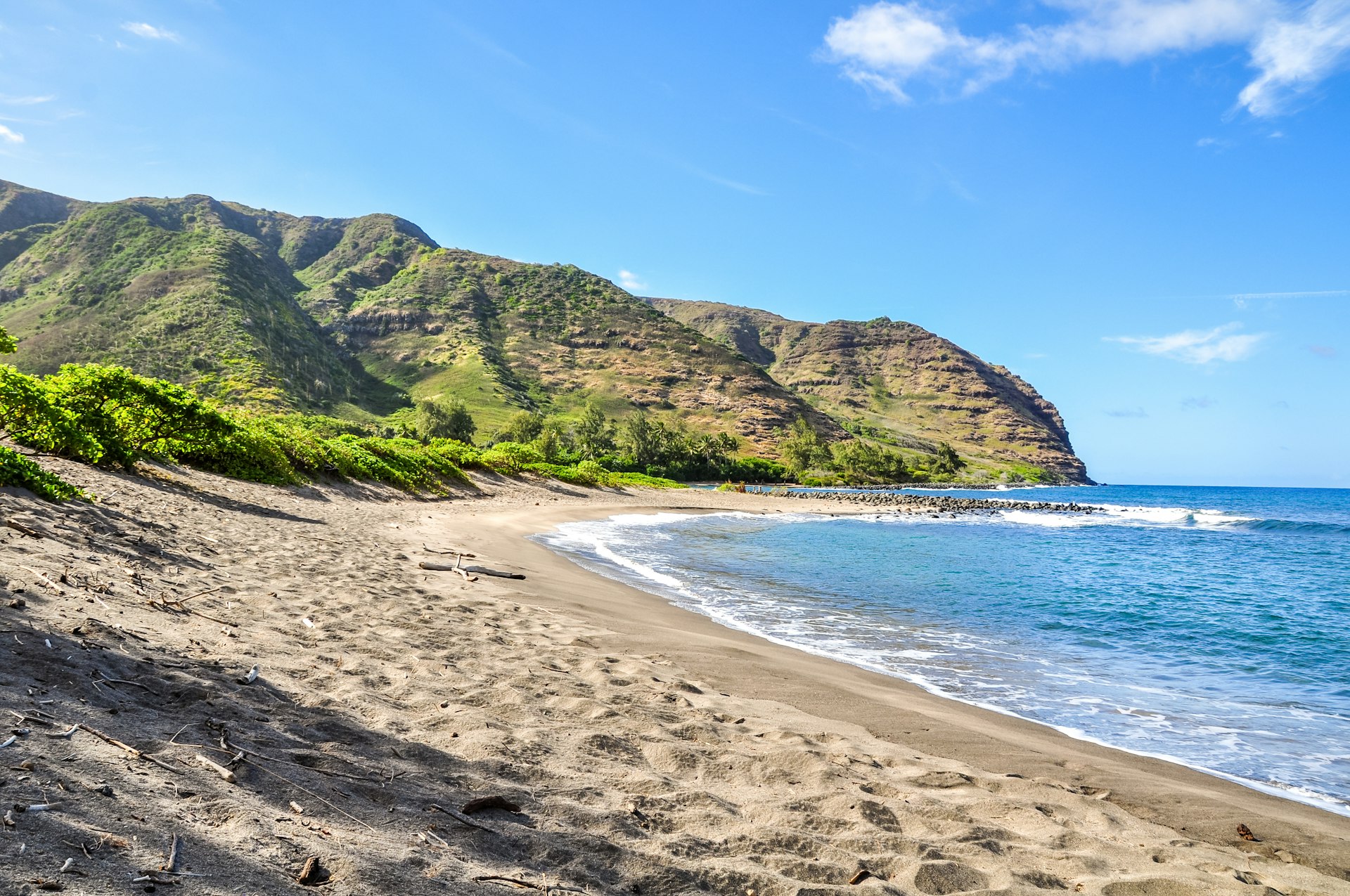
2. Moloka‘i, Hawaii
Hawaii’s friendly isle offers unspoiled nature and flourishing culture
In recent years, there’s been a call to reconsider holidaying in Hawaii, as locals and sustainability experts alike express concerns that the nine million annual visitors are harming the archipelago’s culture and environment. But if Hawaii has been on your wish list for a long time, a considered approach is to explore one of its less-frequented islands.
Despite being the state’s fifth largest island, fewer than 30 tourists a day arrive on Moloka’i during the summer months. The tiny island – only 38 miles long and 10 miles across at its widest point – doesn’t have luxury resorts, trendy bars, big-box retailers or chain restaurants. Heck, there aren’t even traffic lights, and cell phone reception can be spotty at times. But those who make the journey will be rewarded with long sandy beaches with nary another soul in sight, uncrowded hiking trails through old-growth rainforests and rich culture absent of plastic leis.
Getting there: Mokulele Air is the only commercial airline that services Moloka’i, providing nonstop service from Oʻahu, Maui and Hawaiʻi Island aboard nine-seater Cessna planes. Once there, you’ll need a rental car to get around, as there’s no public transit, and taxi services are limited.
When to go: May to October. Spring brings an end to the rainy season, with cooling trade winds and daylong sunshine carrying into autumn.
Pro tip: Bring cash. Not all shops and restaurants on the island accept credit cards.
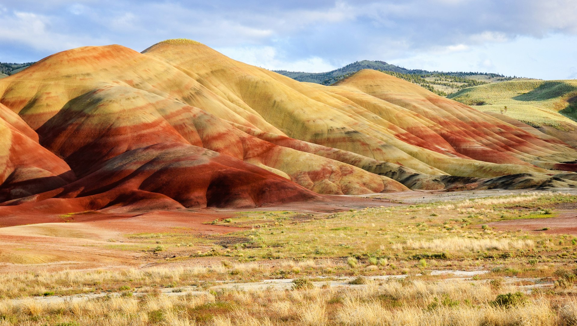
3. John Day Region, Oregon
A diverse biosphere in Central Oregon deserves center stage
From the moment you first see a photo of the John Day Region’s Painted Hills – a kaleidoscope of yellows, golds, blacks and reds, reminiscent of Peru’s Vinicunca (Rainbow Mountain) – you’ll be left wondering how much longer it will stay a relative secret.
But the stunning claystone formations aren't the only geological feature that make this region worth visiting. A range of diverse landscapes is packed into a relatively compact and easy-to-navigate area. You’ll find the old-growth rainforests that Oregon is famous for; canyons similar to those in the Southwest; high-desert plains not unlike those in Big Sky country; and Oregon’s longest undammed river, with sandy beaches and lush meadows on its shores.
According to writer Joshua Samuel Brown, who submitted this entry to Offbeat North America: “You’d need to visit every state west of the Rockies to experience the breadth of terrain encompassed in the John Day Region.”
Getting there: The John Day Region is situated roughly a five-hour drive southeast of Portland. Alternately, it can be accessed from Bend by bus, with Grant County Transportation operating buses between Bend and Prairie City three times a week.
When to go: April to October. For wildflowers in bloom, visit in spring or early summer. Otherwise, aim for the shoulder seasons, when there are fewer visitors and the weather is cooler.
Pro tip: Pack a trowel. The hill behind Wheeler High School in the aptly named town of Fossil is a designated digging spot for amateur paleontologists. Admission is $5.
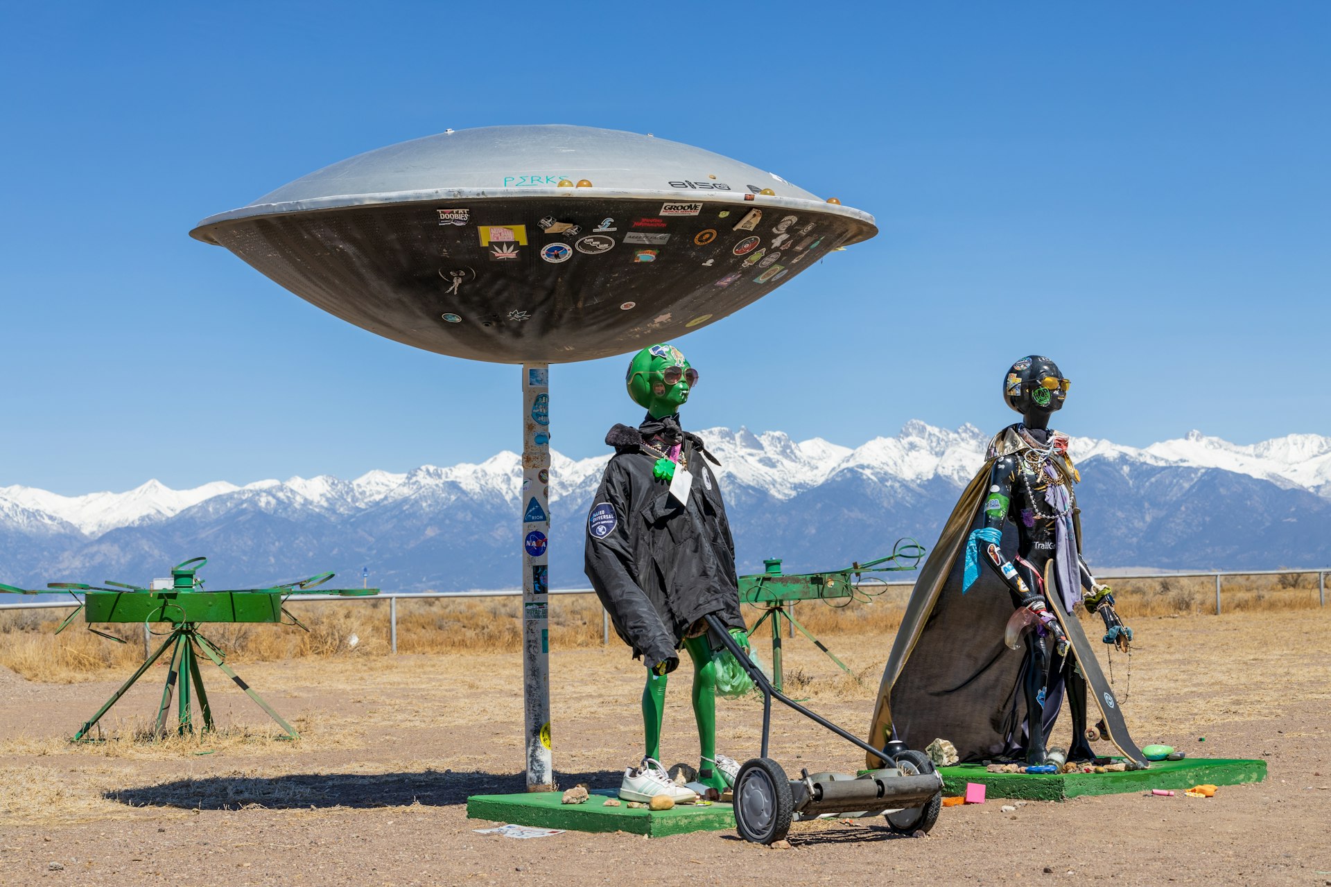
4. Alamosa, Colorado
Wedged between high peaks and serene wildlife refuges, this low-key town proves the truth is out there
There’s no question that Colorado is best known for its ski resorts and mountain vistas – but the Centennial State isn’t a one-trick pony. Head due south from the long lift lines and crowded trailheads near Vail, and you’ll arrive in Alamosa, an high-altitude agricultural community.
If there was a Venn diagram for Alamosa’s typical tourists, they would overlap in their shared love of flying objects. In addition to being a hub for UFO sightings and a major pathway for migratory birds — including the 20,000 sandhill cranes that arrive every spring – Alamosa offers plenty on the ground, too. Its streets are lined with boutiques, antique shops and craft breweries, while it’s only a 30-minute drive from the Great Sand Dunes National Park, home to the tallest sand dunes in North America.
Getting there: The closest to Alamosa is New Mexico’s Albuquerque International Airport. Hire a car to reach your destination, which will take roughly 3.5 hours.
When to go: June to August. Patio season is meant for sipping Alamosa’s craft brews, while providing ideal weather for exploring both the San Luis valley and the nearby Sangre de Cristo mountains.
Pro tip: Give yourself time to acclimatize. Alamosa sits at 7544ft above sea level, so stay hydrated to avoid the effects of altitude sickness.
5. Ice Age Trail, Wisconsin
Hike through glacier-carved landscapes on this long-distance trek
Hiking trails typically don’t conjure up images of overtourism, but it’s an ever-pressing concern in wilderness environments. Popular thru-hikes like the Pacific Crest Trail (PCT) even employ lottery systems for permits, all in a bid to limit foot traffic.
That’s why Wisconsin’s Ice Age Trail – a 1,200-mile trail zigzagging across the state – might be worth considering first. While still a work in-progress (it includes connecting trails and country roads), it’s less strenuous and shorter than the PCT or the Appalachian Trail. And thus far, less than 500 people have hiked it in entirety, meaning there’s still bragging rights up for grabs.
If you don’t have that much time to spare, opt for the 600-mile “Ice Age” segment, which carries hikers through wooded hills and glittering lakes formed by an ancient glacier. Along the way, camp trailside or stay in small communities, helping to support the livelihoods of the area’s locals.
Getting there: The easiest trailhead to access is the western end, in St Croix Falls, Minnesota, about 55 miles from Minneapolis. The trail’s trickier-to-reach eastern end is in Potawatomi State Park in Sturgeon Bay, Wisconsin. From either spot you’ll need wheels to reach the trailheads.
When to go: April to October. Although winter is the trail’s quietest time, it’s also when portions close due to hunting seasons. Instead, opt for spring or autumn, when insects and temperatures are both more manageable.
Pro tip: The Ice Age Trail may be less trafficked than its more famous contemporaries, but it still has its fair share of trail angels, who provide support in the form of shuttles, lodging and showers. The Ice Age Trail Alliance has contact information for these volunteers.
6. Alabama
An unlikely destination for underground outdoor adventures
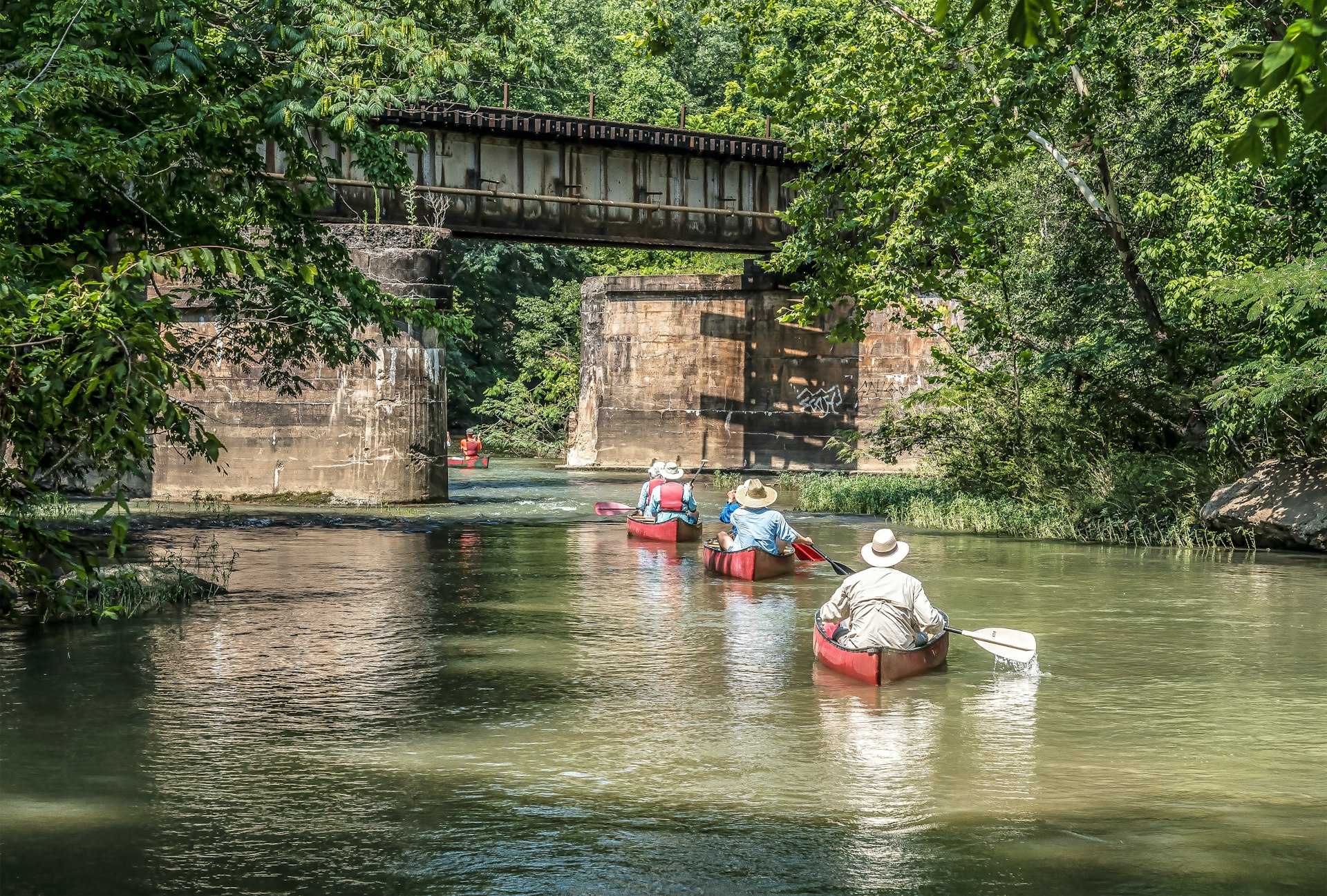
If you’re a member of the paddling community, you probably know that Alabama offers some of the country’s best canoeing and kayaking, with 6,300 miles of accessible waterways. What you might not know is that its underground adventures are just as incredible, with an astounding 4,800 known caves in the state. (Jackson County, in the state’s northeast corner, has the most caves per mile in the entire US.)
Some caves are easy to explore and others require specialized spelunking skills, but each is more spectacular than the last. In the Dismals Cave, you can stare up in awe at the phosphorescence of glowworms. In Rickwood Caverns State Park, you can swim in an Olympic-sized pool fed with cave water. Manitou Cave contains inscriptions from the Cherokee Nation on a 50-foot-high ceiling, written over 200 years ago. And during summer evenings, more than 250,000 bats can be seen emerging from Sauta Cave. With adventures like these, Alabama might just be the most “underground” destination in the book.
Getting there: Alabama has three major airports: Huntsville, Birmingham and Montgomery. It’s also well connected by road to major cities like Atlanta, Nashville and New Orleans. No matter how you get here, you’ll need a car to get around.
Best time to visit: May to October. Despite the summer heat, temperatures inside the caves stay the same year-round, with summer being the best chance to see bats in flight.
Pro tip: Plot our your cave visits in advance, as even some of the most sought-after caves (including Sauta Cave Wildlife Reserve and Manitou Cave) may not have dining or restrooms nearby.
7. “Ukrainian Bloc,” Alberta
Outrageous roadside attractions in Alberta’s offbeat cultural mosaic
Fans of “Giant Things,” we see you. There’s no shortage of them northeast of Edmonton, Alberta, where the roadside attractions follow a definite theme: There’s Vegreville’s giant pysanka (Ukrainian Easter egg), Glendon’s giant perogy (Ukrainian dumplings, also spelled pierogi) and Mundare’s giant kovbasa (Ukrainian sausage). Around the turn of the century, this pocket of the prairies was home to the largest colony of Ukrainian settlers in Canada.
Its Eastern European heritage is still evident in the metallic domes of the Ukrainian churches dotting the countryside and celebrated at attractions like the Ukrainian Cultural Heritage Village. However, until recently, a lack of accommodation meant that visitors typically just drove on through – but that’s no longer the case, thanks to Métis Crossing. Over the last two years, the cultural center has opened a boutique lodge and stargazing domes on the edge of the North Saskatchewan River, the latter a perfect vantage point from which to watch the northern lights dance at night.
Getting there: The Ukrainian Bloc doesn’t have defined boundaries, but most communities run alongside Highways 16 and 28 east and northeast of Edmonton. You’ll need a car to get to the Ukrainian Cultural Heritage Village (a 30-mile drive east of Edmonton), while Métis Crossing is a 75-mile drive northeast.
Best time to visit: May to October. Some attractions, including the Ukrainian Cultural Heritage Village, are only open seasonally from late May until early September, so check opening hours in advance.
Pro tip: Bring a cooler to stock up on food made by the area’s babas. Smoky Lake’s bakery stocks bags of frozen pierogies and borscht (beet soup). Similarly, Stawnichy in Mundare sells freezer packs of cabbage rolls, kielbasa sausage rings and perishke (cheese buns).
8. Ruta Puuc Yucatán, Mexico
Discover ancient Maya architecture on a less-explored Yucatán route
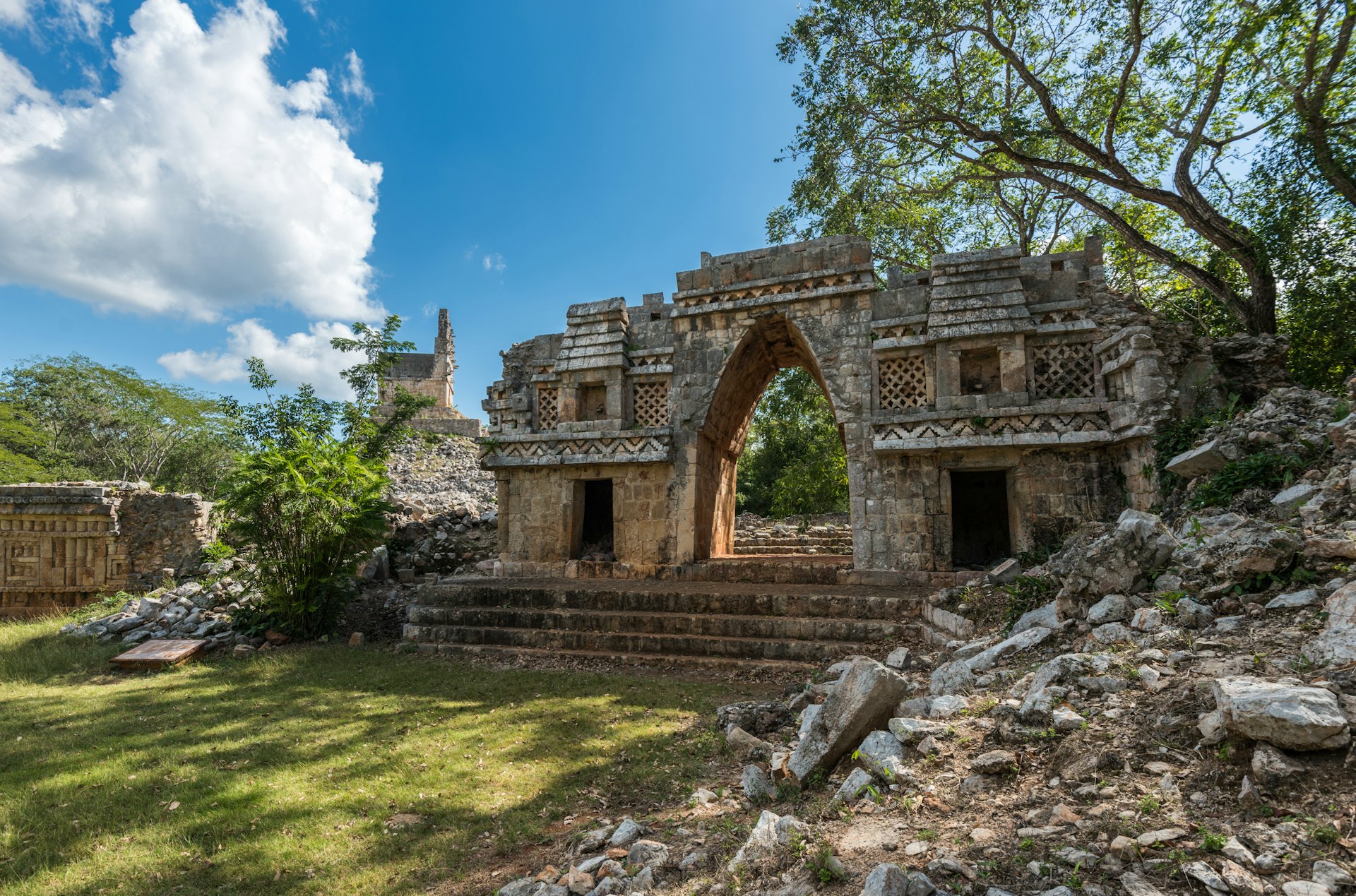
As one of the “new” seven wonders of the world, it’s easy to understand why more than 2.5 million visitors flock to Chichén Itzá every year. But only about 40,000 will collectively make it to Labná, Sayil and Xlapak, three Maya sites that are part of the wider Uxmal Unesco World Heritage site.
Nestled in the hilly Puuc region, south of Mérida, these richly adorned archeological sites mark a high point in Maya architecture. With its monumental arch, elaborate carvings and temple-topped pyramid, Labná is the highlight for many, but there’s a special kind of magic in stumbling across a half-lost building at Sayil, hidden in the forest. Along the way, stop to cool off in sparkling cenotes or sample Yucatecan food.
Getting there: The route begins 70 miles south of Mérida (a 90-minute drive), where a smaller road branches off Hwy 261 toward Sayil then continues on to Xlapak and Labná. Guided tours are also available from Mérida.
Best time to visit: September to April. Skip the hot, humid summer months. From September onwards, the weather cools down and the crowds thin out.
Pro tip: Time your visit for when the sites open at 8am. Chances are, you’ll be one of the only visitors in the cool morning air.