With its strategic position on the west bank of the Río de la Pasión, the independent kingdom of Ceibal amassed considerable power controlling commerce along this key stretch of the waterway. Though architecturally less amazing than some other sites, the river journey to Ceibal is among the most memorable, as is hiking below the jungle canopy with monkeys howling overhead.
Unimportant during most of the Classic period, Ceibal (sometimes spelt Seibal) grew rapidly in the 9th century AD. It attained a population of around 10,000 by AD 900, then was abandoned shortly afterwards. Its low, ruined temples were quickly covered by a thick carpet of jungle. Excavation of the site is ongoing under the supervision of University of Arizona archaeologist Takeshi Inomata.
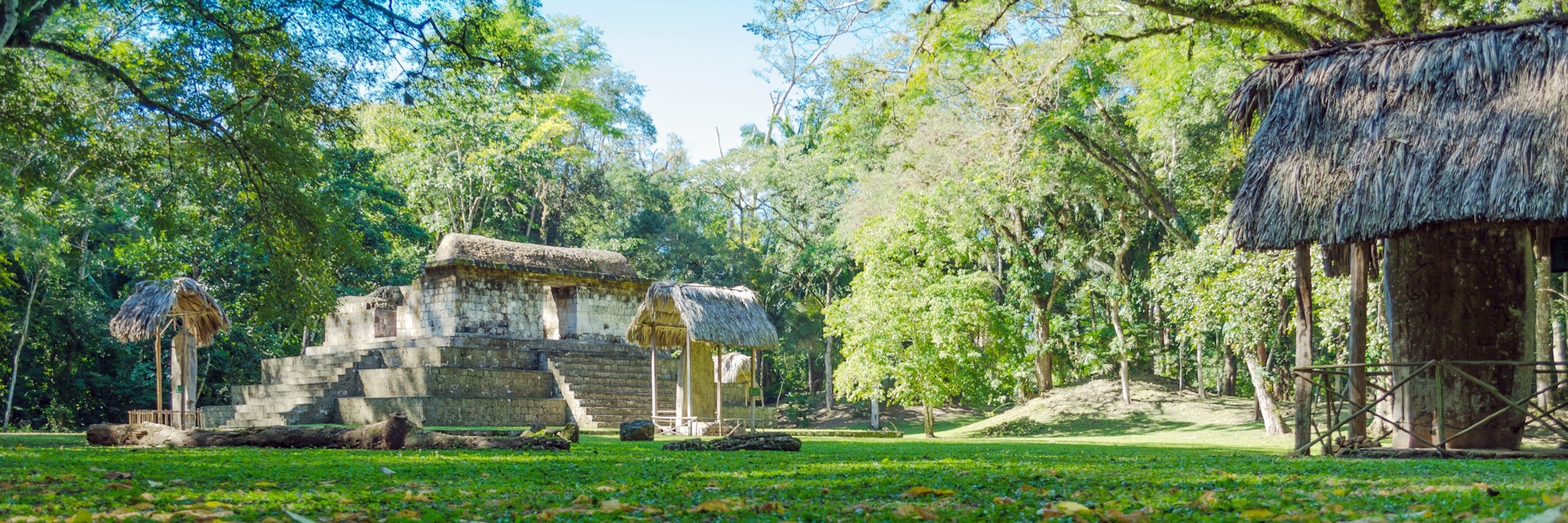
A one-hour ride up the Río de la Pasión from Sayaxché brings you to a primitive dock. After landing, you clamber up a narrow, rocky path beneath gigantic ceiba trees and jumbles of jungle vines to reach the archaeological zone, perched about 100m above the river.
There's a large scale model of the site by the entrance. The ceremonial core of the city covers three hills, connected over steep ravines by the original causeways. Smallish temples, many of them covered with jungle, surround two principal groups, A and D. In front of some temples, and standing seemingly alone on paths, are magnificent stelae, their intricate carvings still in excellent condition.
It takes about two hours to explore the site. Bring mosquito repellent!
Most of the stelae appear at Grupo A, made up of three plazas at the site's highest point. At the best excavated of these, Plaza Sur, stands Structure A-3, a pyramidal platform with a stela on each side and one at the top. Some of the characters depicted here have distinctly non-Maya features and dress, which has led to speculation that foreigners once inhabited the area. According to one hotly debated theory, the city was invaded by Putun Maya, a race of merchant-warriors from the Tabasco area of Mexico, around the middle of the 9th century. This might account for the 'foreign' look of the mustachioed warrior on stela 11, for example, who stands on the east side of the platform.
Calzada I leads east to Grupo D, a more compact series of temples that backs up against a precipitous gorge. About midway is a turnoff south for Calzada II, just beyond which is the fantastically preserved stela 14, which may depict a tax collector. Proceeding down Calzada II to the south, you reach the intriguing Structure 79. Three stone steps surround the unusual ring-shaped structure, which stands alone in a clearing with a small altar in the shape of a jaguar's head. It is believed to have served as an astronomical observatory, from which the inhabitants studied planetary movements.
Viajes Don Pedro in Sayaxché runs lanchas (small motorboats) here (Q700 for up to five passengers). The fee should include a guide, who may actually be the boatman. In high season, ask the lancheros about joining a tour group.
Alternatively, Ceibal can be reached overland: get any minibus heading south from Sayaxché on Hwy 5 (toward Raxrujá and Chisec) and get off after 9km at Paraíso, from where it's an 8km walk east down a dirt track to Ceibal. About 2km in, where the road bends left by a small farmhouse, continue straight uphill to enter the park – there's no sign. In the rainy season check with locals first that this stretch is passable.
