Gilgit
The Uprising Memorial, is a memorial to those who rose against the Maharaja in 1947. It includes the graves of the local heroes, Mohammed Babar Khan and…
Getty Images
Gilgit
The Uprising Memorial, is a memorial to those who rose against the Maharaja in 1947. It includes the graves of the local heroes, Mohammed Babar Khan and…
Karakoram Highway
The oldest parts of Baltit Fort date from the 13th century. Over the years more houses and towers were added, and it was fortified. To cement an alliance…
Karakoram Highway
The restoration of Ganish Village is particularly good and won a Unesco Asia Pacific Heritage Award. While Baltit Fort shows how the cream of society…
Karakoram Highway
Chilas is surrounded by wonderful Petroglyphs, which are easy to access, though be prepared for high temperatures and take plenty of water. There is a…
Karakoram Highway
A three- or four-hour walk along the main water channels from Ultar Nala is a good way to see Hunza at its best. Try to avoid the delicate side channels.
Karakoram Highway
Ali Sher Khan probably built the fort on the east end of this rock in the 17th century, but the Dogras trashed and rebuilt it. It's a half-hour climb to…
Karakoram Highway
On the north side of town is Mansehra's tourist attraction, three granite boulders on which 14 edicts were engraved by order of the Mauryan king Ashoka in…
Karakoram Highway
The Queen Victoria Monument at the top of the rock face behind Karimabad can be reached in an hour from Baltit. Take the channel path above the polo…
Filter by interest:
Wildlife & Nature
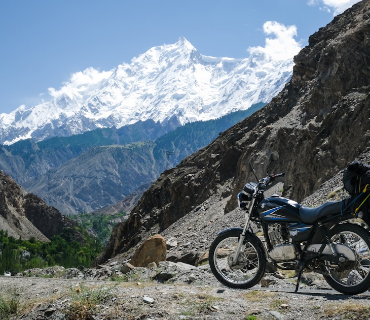
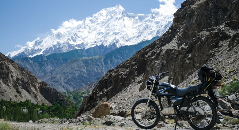
Joining the bikers of Gilgit-Baltistan: exploring Northern Pakistan by motorcycleDec 17, 2019 • 6 min read
Get to the heart of Karakoram Highway with one of our in-depth, award-winning guidebooks, covering maps, itineraries, and expert guidance.