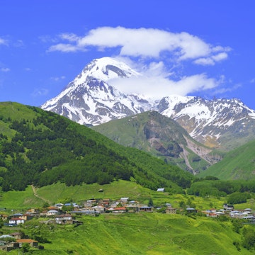
Stepantsminda
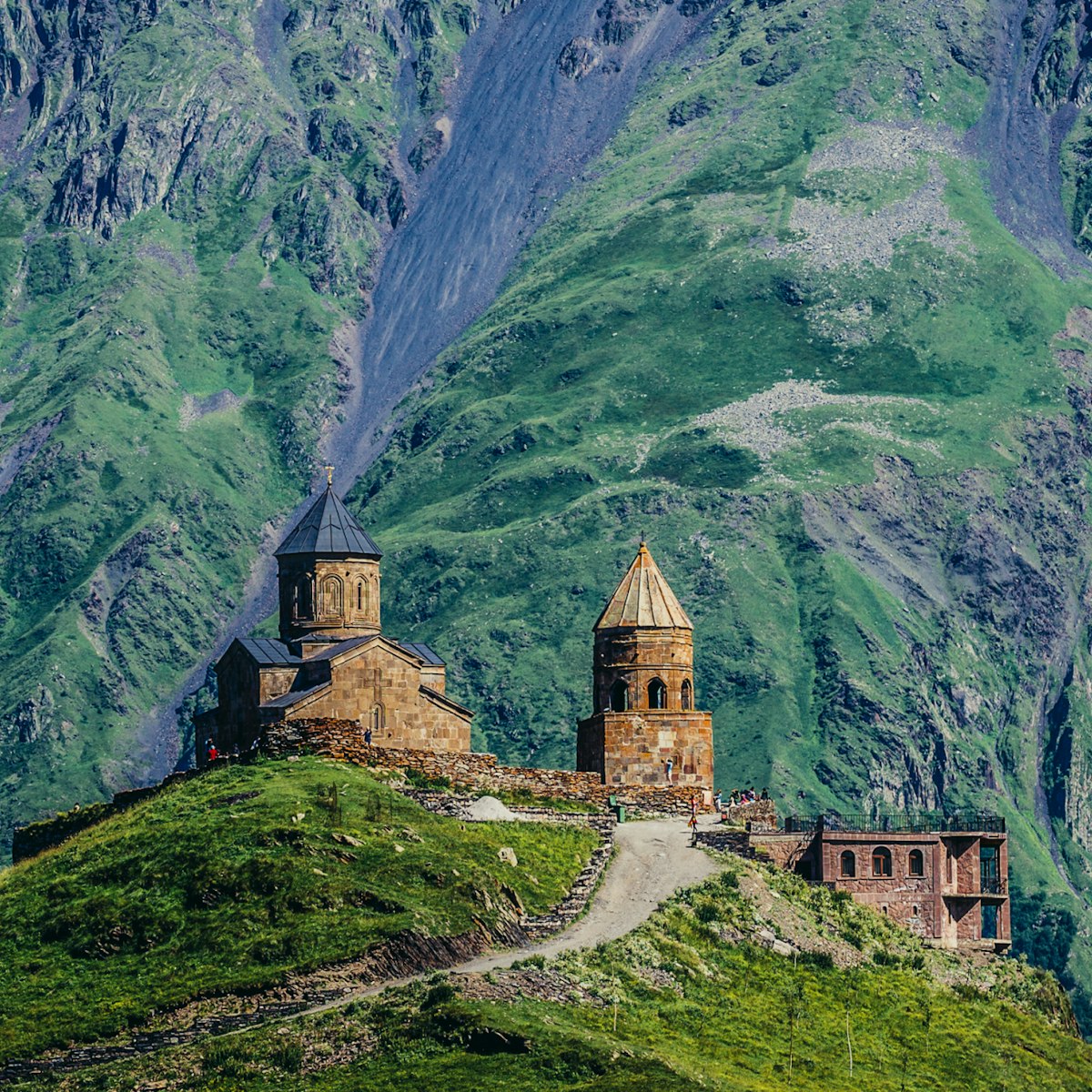
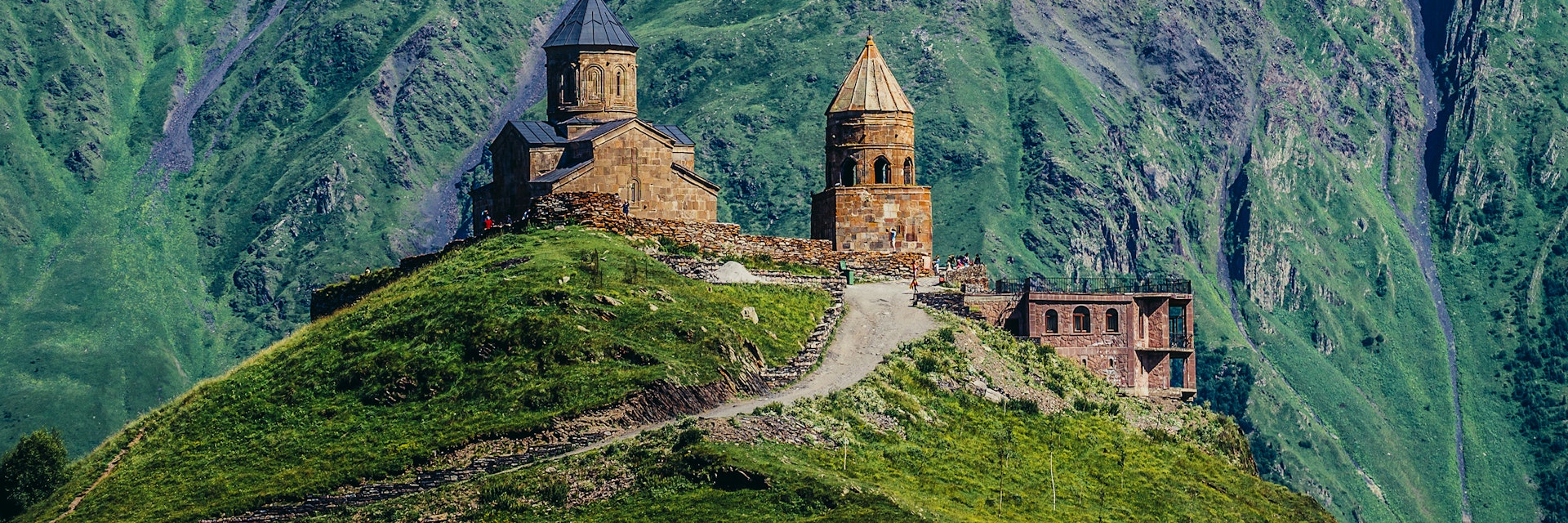
This 14th-century church 2200m above Stepantsminda has become almost a symbol of Georgia for its incomparably photogenic hilltop setting with mighty Mt…
©Fotokon/Shutterstock
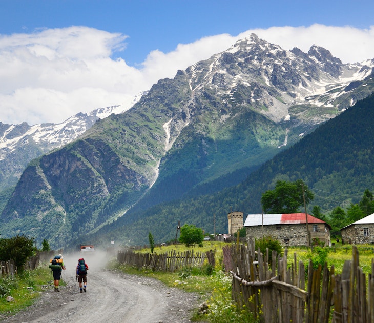
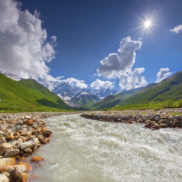
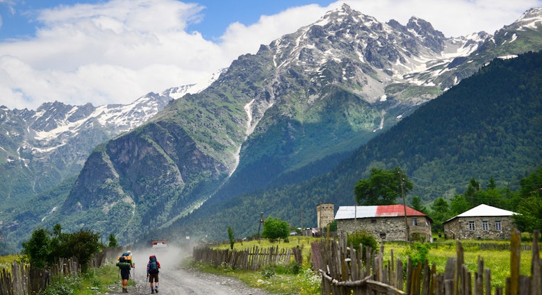
A trip into the Great Caucasus along Georgia’s northern border is a must for anyone who wants to experience the best of the country. Spectacular mountain scenery, wonderful walks and picturesque old villages with strange defensive towers are all part of a trip to the southern side of Europe's highest mountain range.
Stepantsminda
This 14th-century church 2200m above Stepantsminda has become almost a symbol of Georgia for its incomparably photogenic hilltop setting with mighty Mt…

Great Caucasus
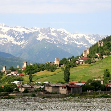
This magnificent agglomeration of koshkebi (defensive watchtowers) and atmospheric slate houses packed tightly together on a steep hillside to create one…
Svaneti History & Ethnography Museum
Mestia
Mestia’s excellent main museum is one of Georgia's best, with fascinating displays of church treasures, manuscripts, weaponry, jewellery, coins and…
Tusheti
Dartlo, 12km northwest of Omalo in the Pirikiti Alazani valley, is an extraordinarily picturesque village crowned by an impressive tower grouping,…
Great Caucasus
This fortress 66km north of Tbilisi is a classic example of Georgian architecture, enhanced by its superb location overlooking the Zhinvali Reservoir. The…
Great Caucasus
The beautiful Truso valley, source of the Tergi River, heads west off the Georgian Military Hwy 17km south of Stepantsminda. It's dotted with ancient…
Omalo
Constructed during the Mongol invasions during the 1230s, these five towers form a protective fortress on the hilltop above Zemo Omalo where locals would…
Soviet-Georgian Friendship Monument
Great Caucasus
This highly unusual concrete monument a short distance from the main Georgian Military Hwy and some 4km north of Gudauri is also known as the Gudauri View…
Filter by interest:
Get to the heart of Great Caucasus with one of our in-depth, award-winning guidebooks, covering maps, itineraries, and expert guidance.