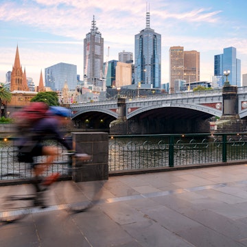
Melbourne
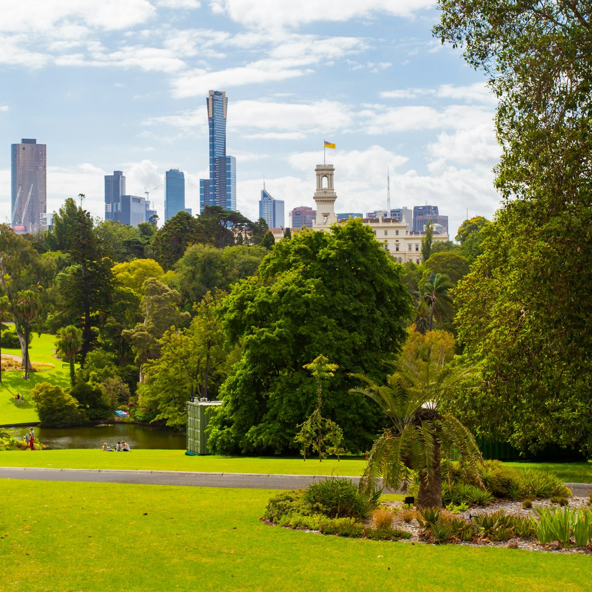
Considered one of the finest examples of Victorian-era landscaping in the world, Melbourne’s Royal Botanic Gardens draw over two million visitors a year…
Pete Seaward
Melbourne is food-obsessed, marvellously multicultural and a showpiece for Australian culture. Beyond the city limits, Victoria offers rich history, stunning wilderness and culinary excellence.
Melbourne
Considered one of the finest examples of Victorian-era landscaping in the world, Melbourne’s Royal Botanic Gardens draw over two million visitors a year…
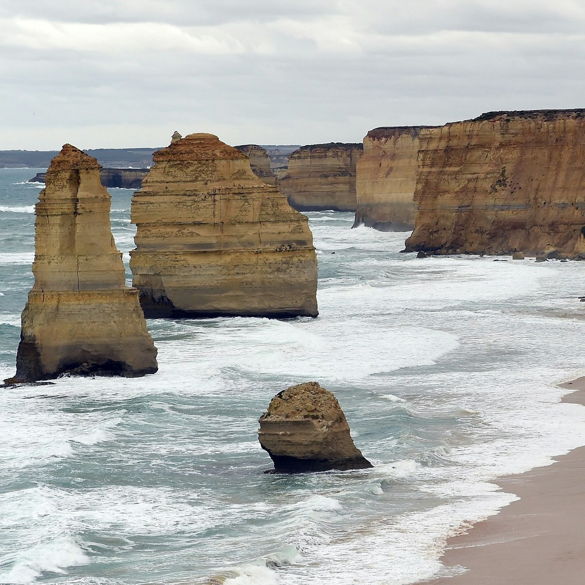
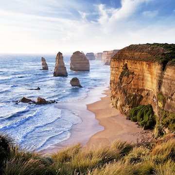
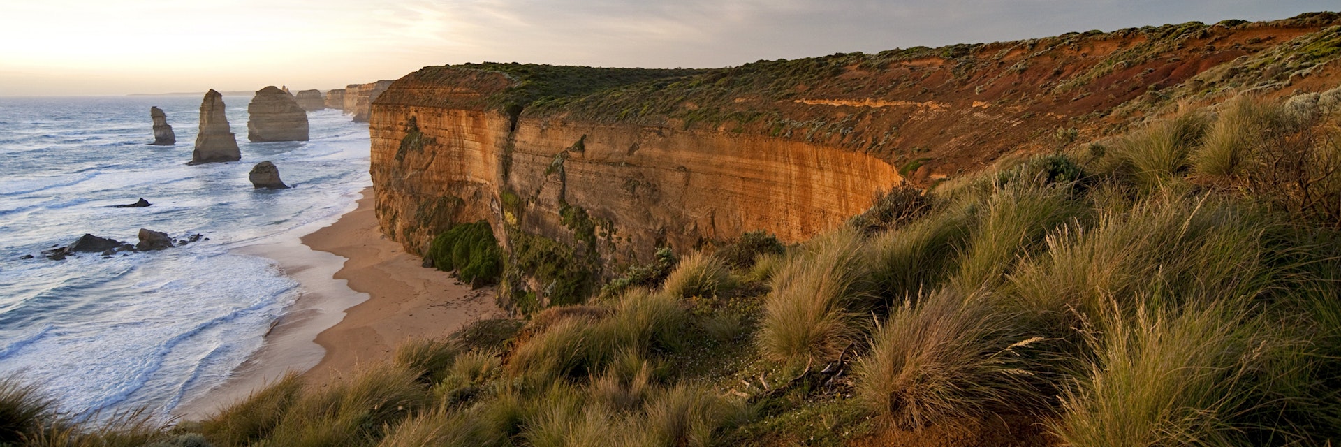
Great Ocean Road
The most iconic sight and enduring image for most visitors to the Great Ocean Road, the Twelve Apostles provide a fitting climax to the journey. Jutting…

Melbourne
Melbourne's most-celebrated laneway for street art, Hosier Lane's cobbled length draws camera-wielding crowds to its colorful canvas of graffiti, stencils…
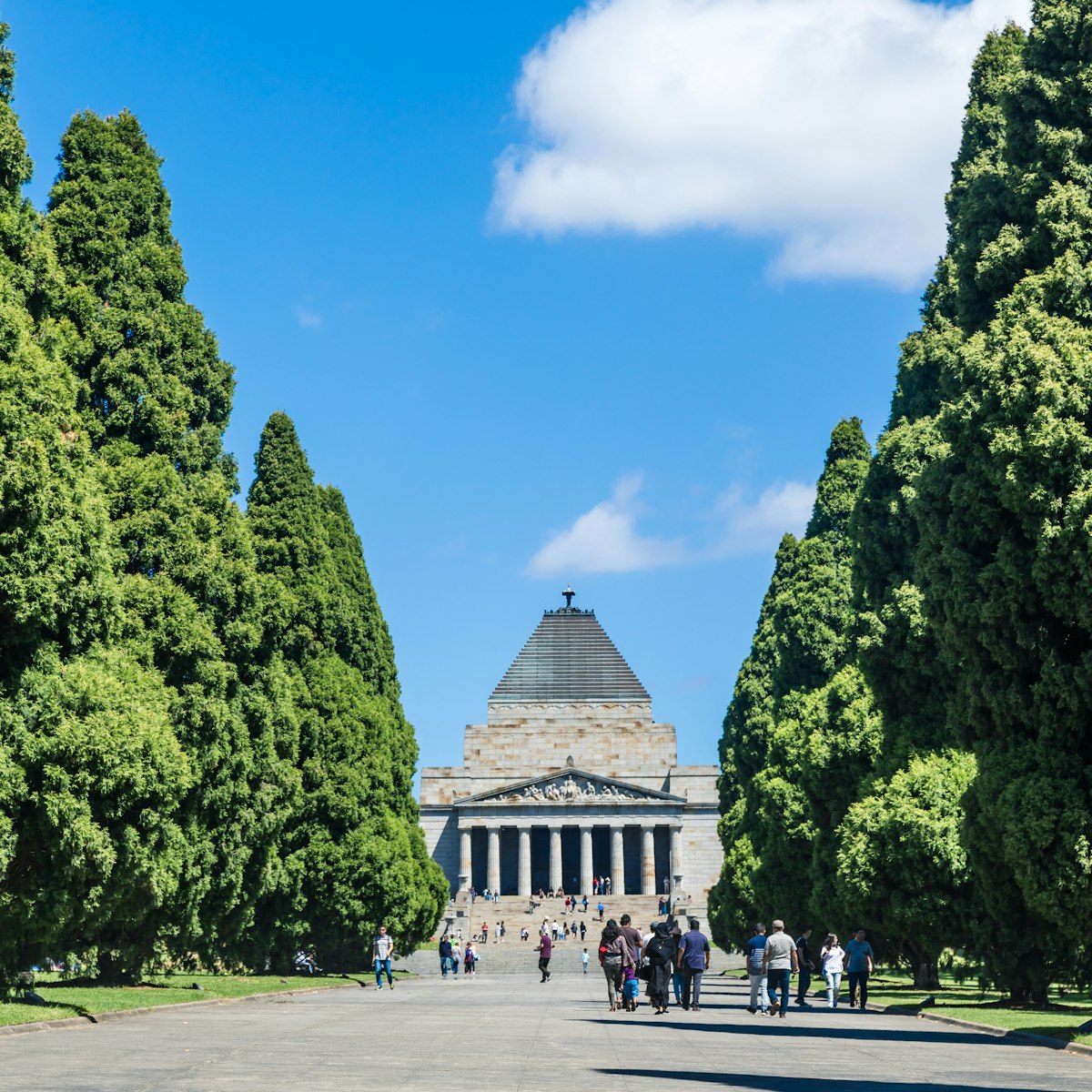
Melbourne
One of Melbourne's icons, the Shrine of Remembrance is a commanding memorial to Victorians who have served in war and peacekeeping, especially those…
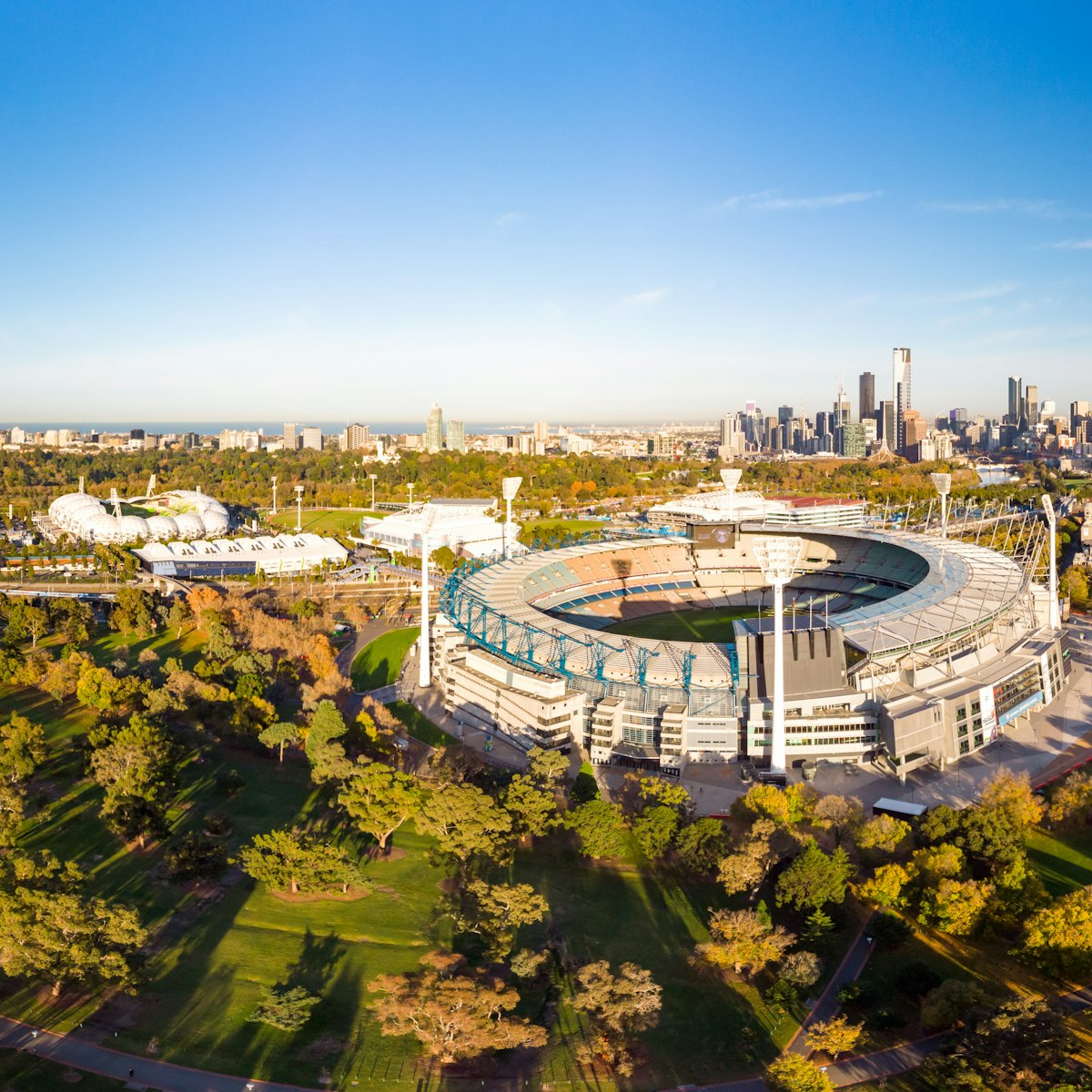
Melbourne
With a capacity of 100,000 people, the "G" is one of the world’s great sporting venues, hosting cricket in summer and AFL (Australian Football League,…
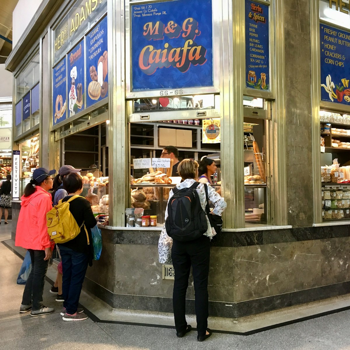
Melbourne
With more than 600 traders, 'Vic Market' is a large open-air market brimming with food, shopping and cultural experiences. Early mornings are best for…
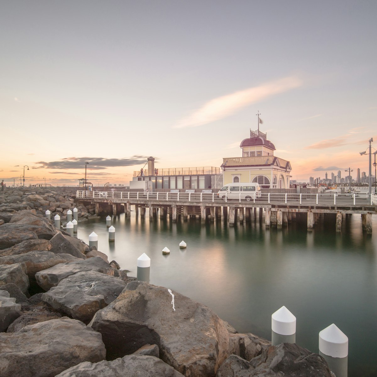
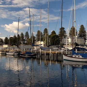
St Kilda, Elwood & Elsternwick
With a palm-fringed promenade, sandy beach and eclectic architecture, St Kilda’s seaside appeal lands somewhere between Brighton in England and Venice…
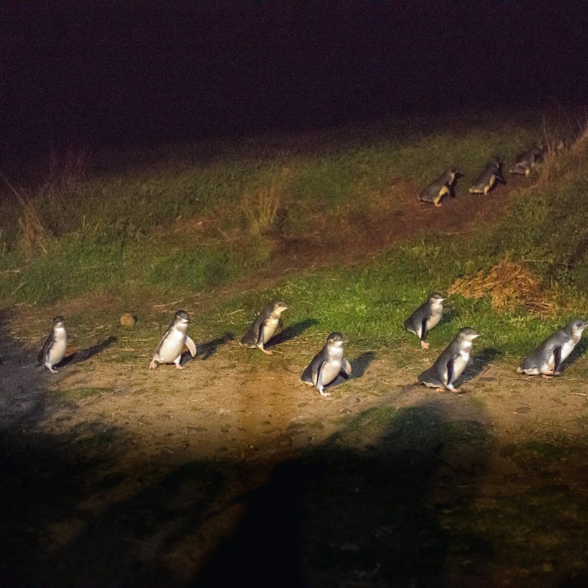
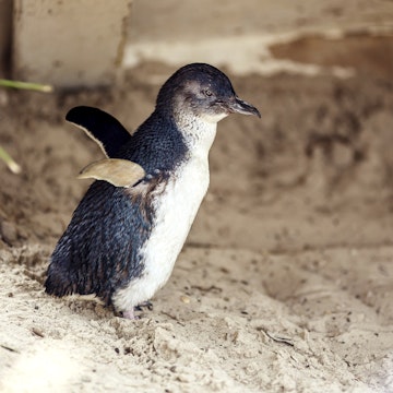
Phillip Island
One of Victoria's major tourist draws, this evening parade of little penguins (Eudyptula minor) showcases the world’s smallest, and probably cutest,…
Filter by interest:


May 27, 2020 • 2 min read


in partnership with getyourguide
Get to the heart of Victoria with one of our in-depth, award-winning guidebooks, covering maps, itineraries, and expert guidance.